The Grand Circle Tour – Final Post

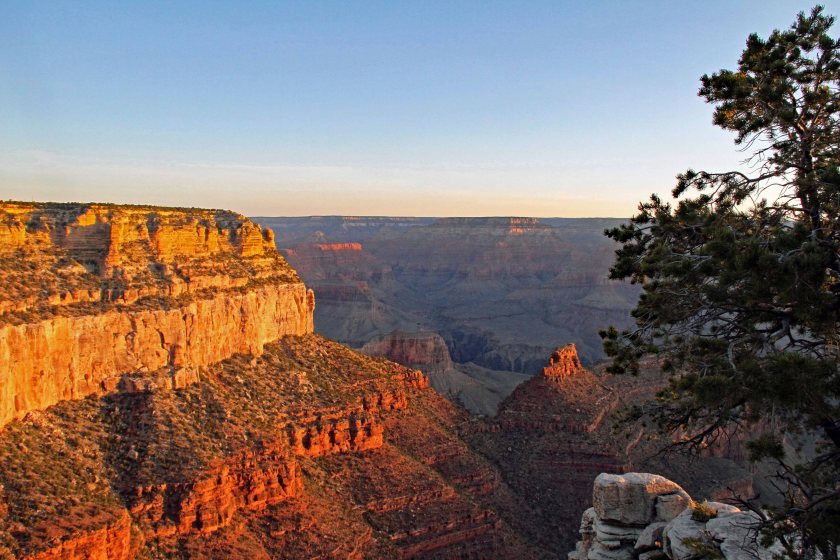
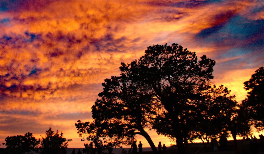
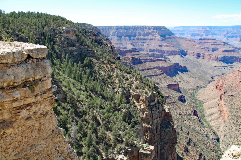
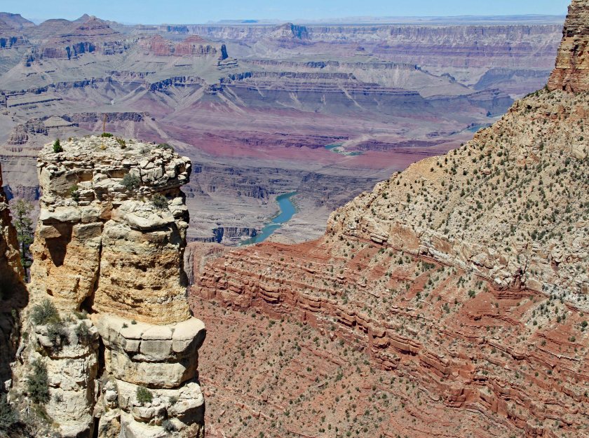
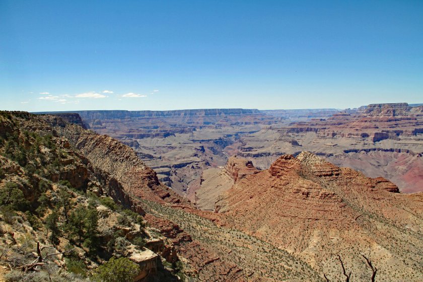
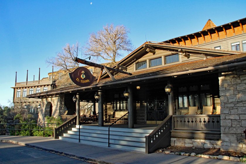
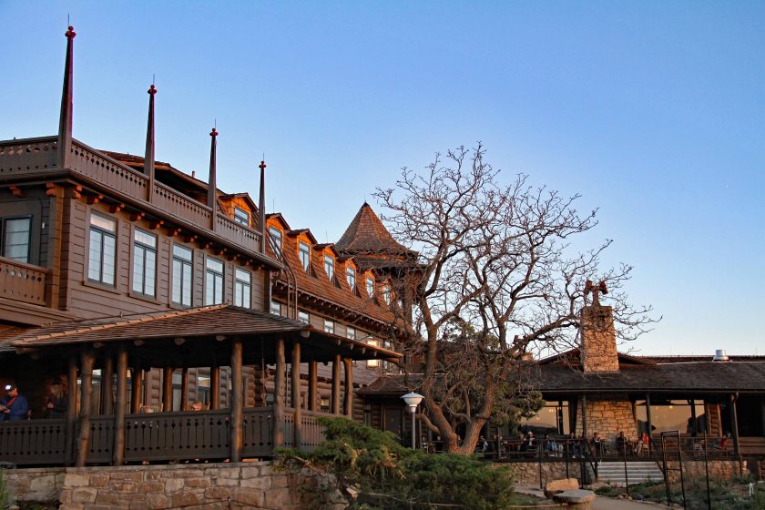
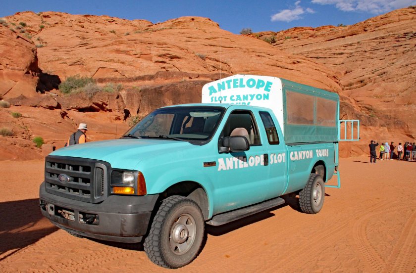
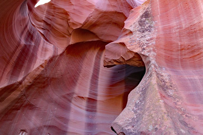
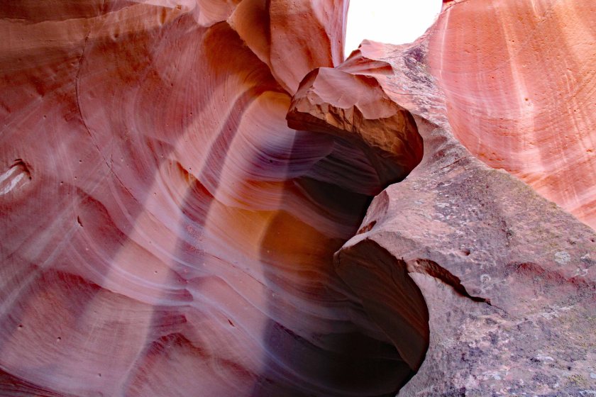
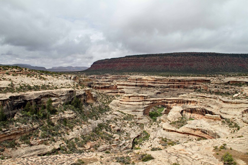
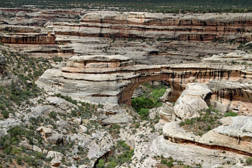
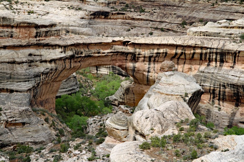
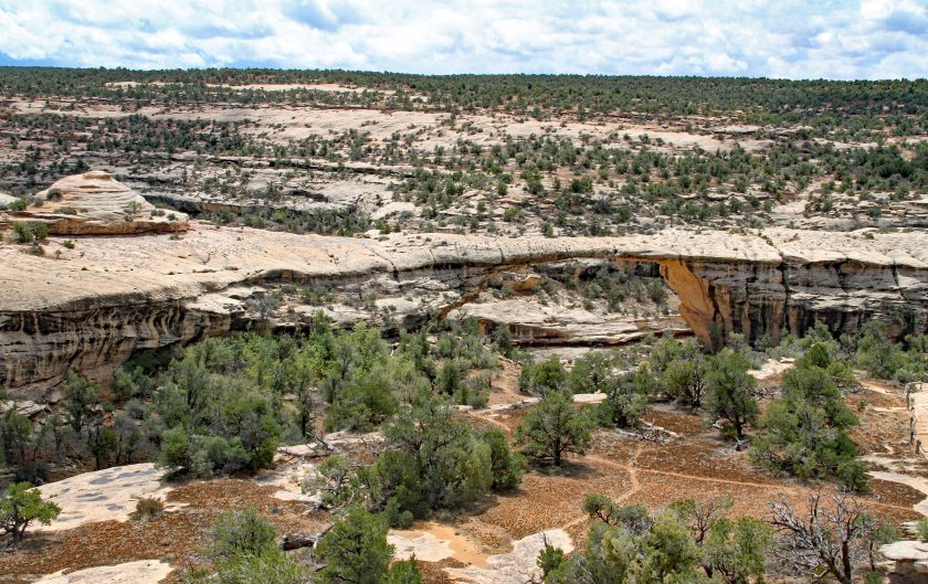
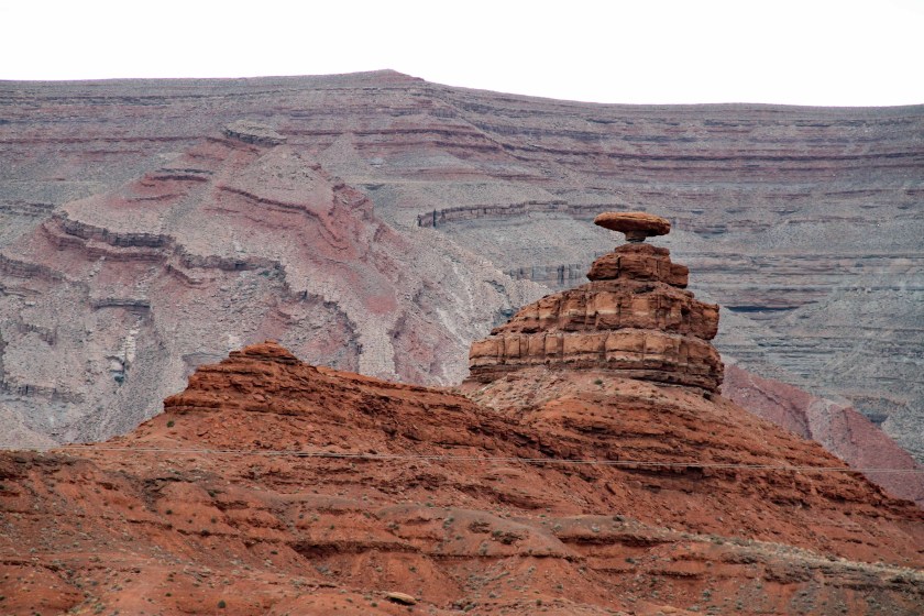
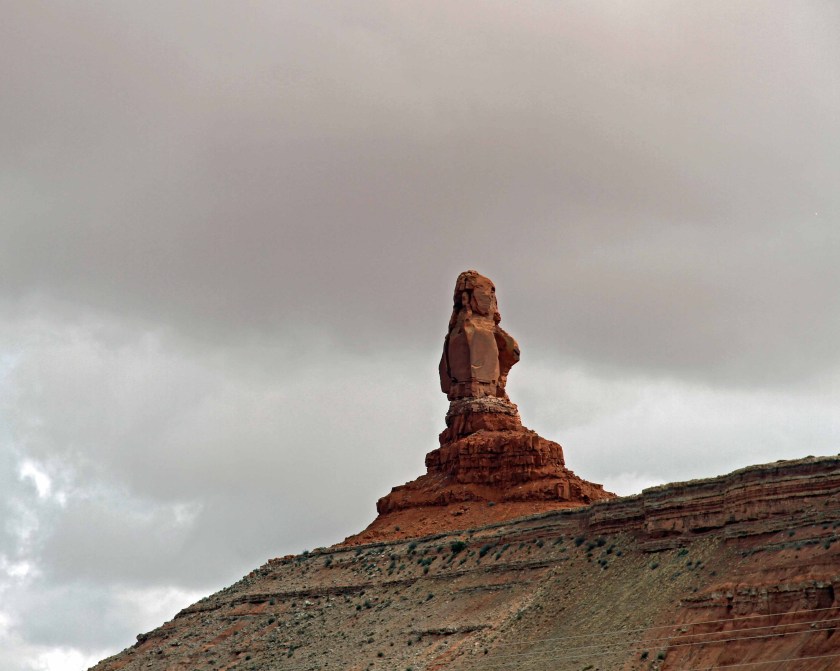
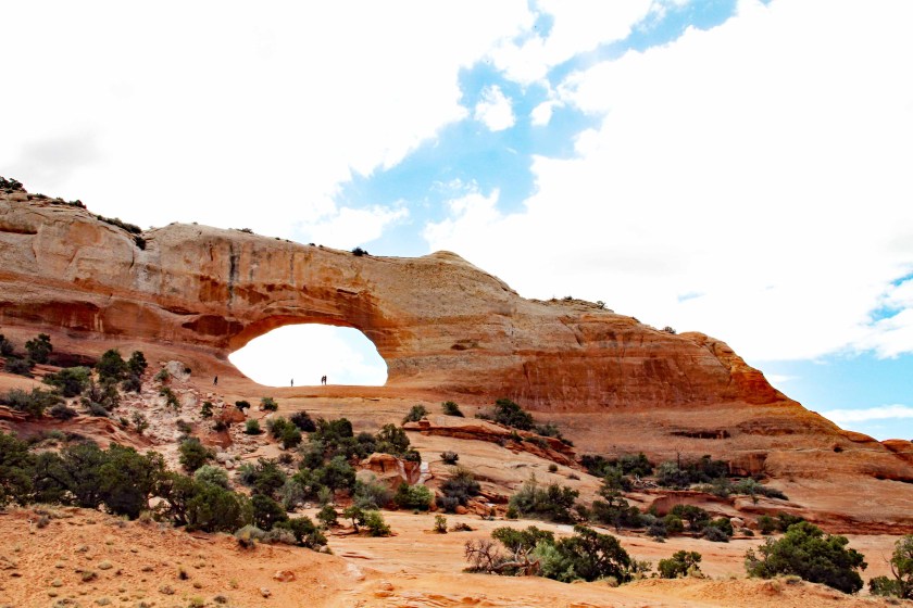
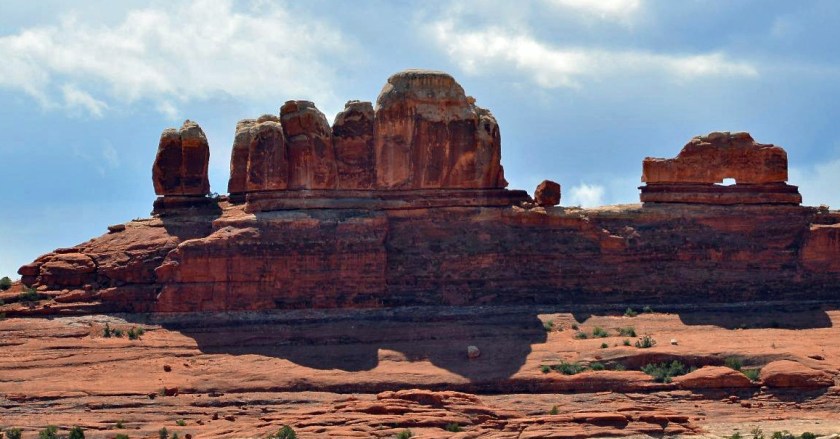
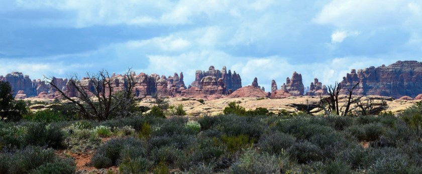
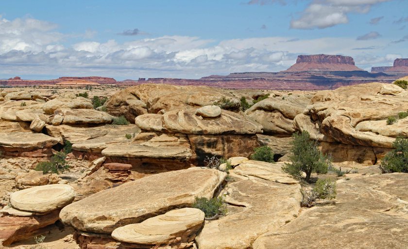
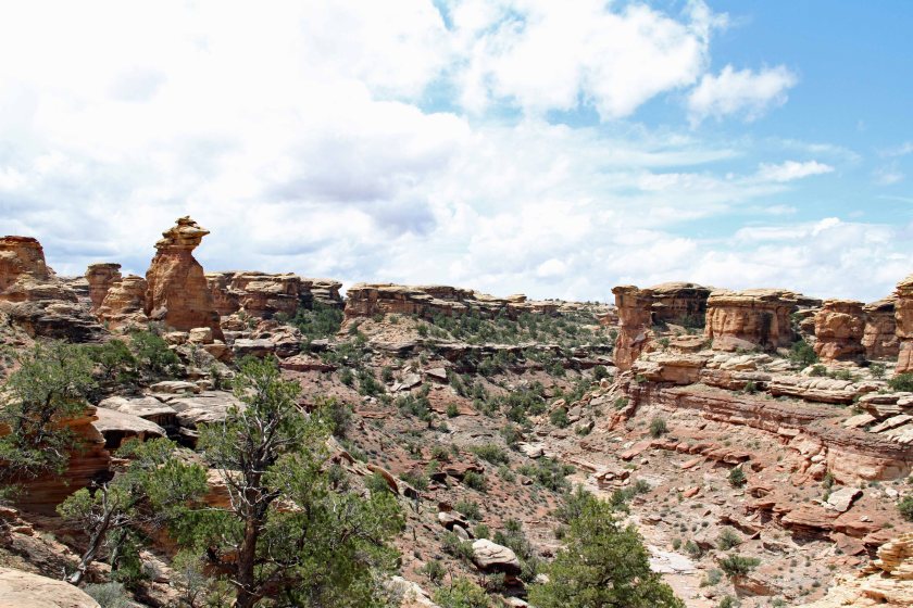
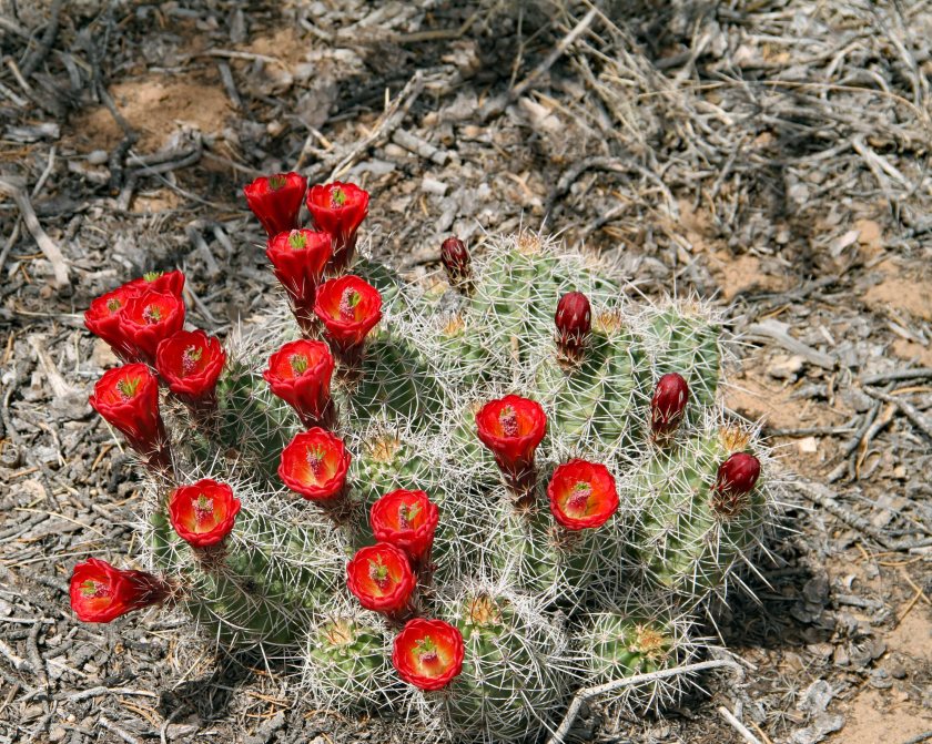
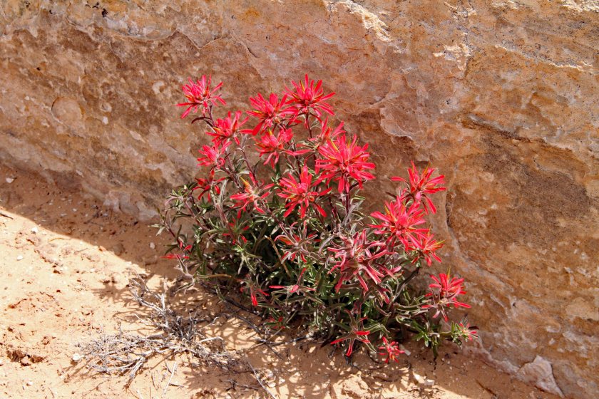
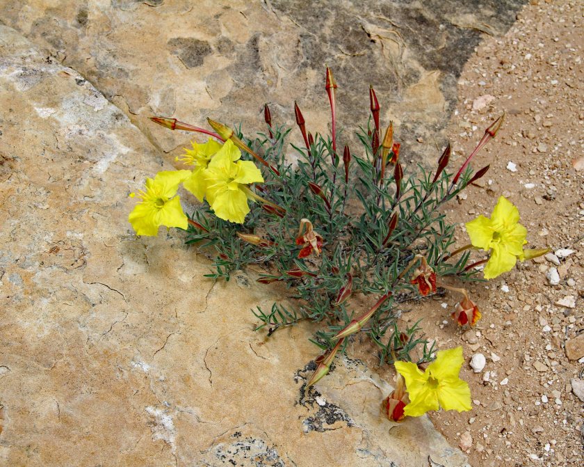
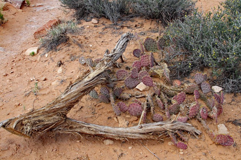
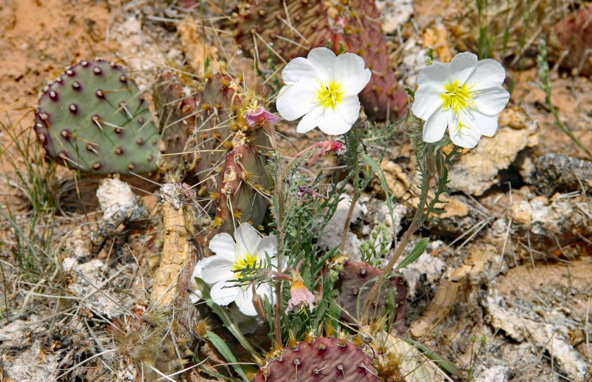
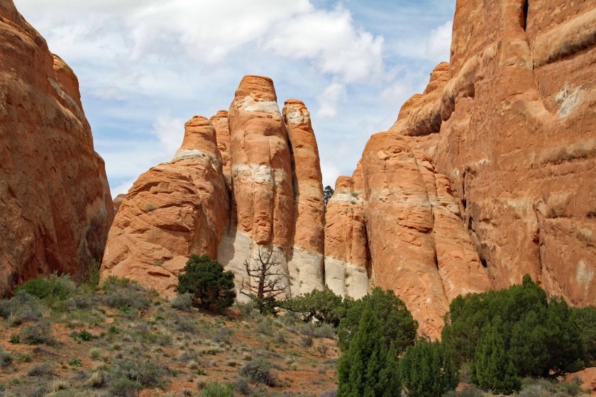
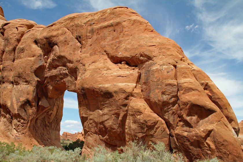
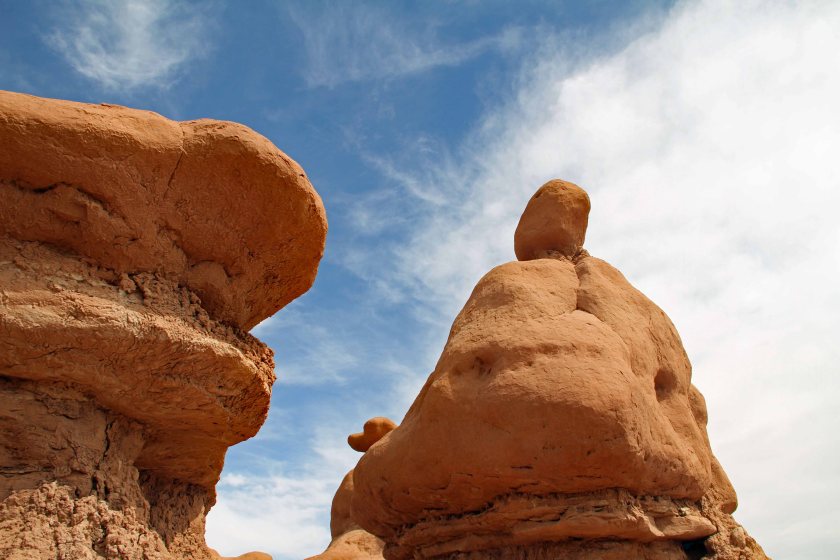
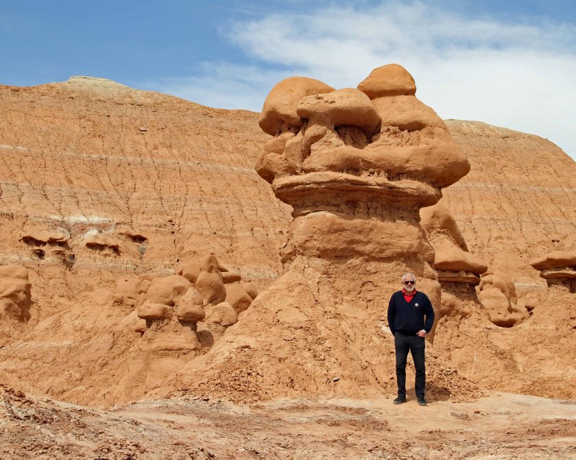
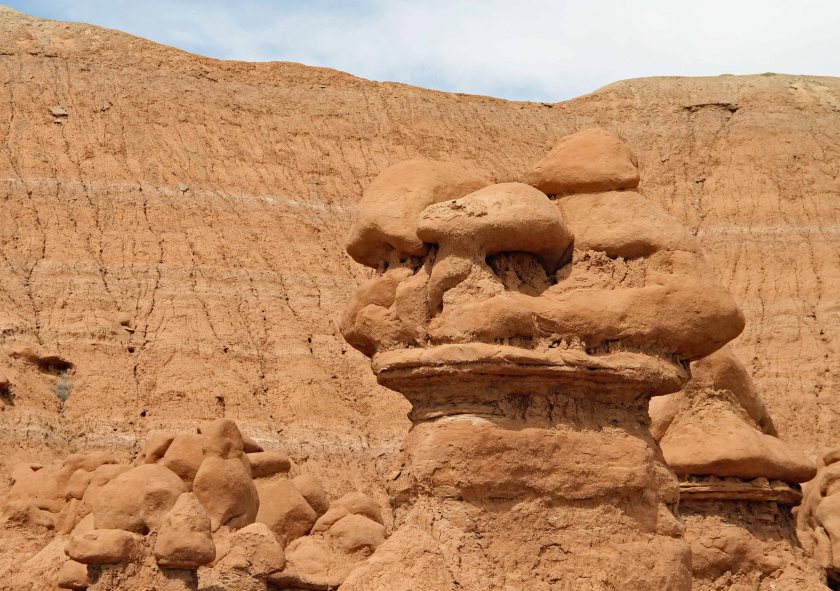
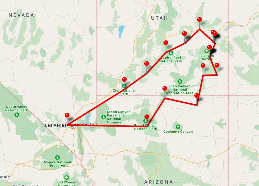
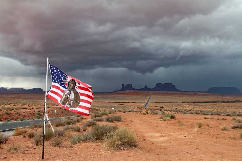
It is said that all good things must come to an end and sadly, our Grand Circle Tour did as well.  It was an amazing trip, covering three states, over 1,600 miles, six national parks, multiple state parks, and so many other points of interest along the way.  We were in awe of nature’s beauty and felt honored to be able to experience landscapes that took literally millions of years to be created.

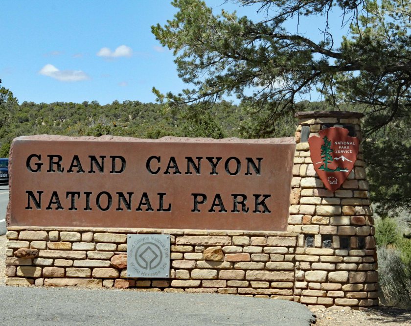
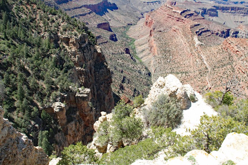
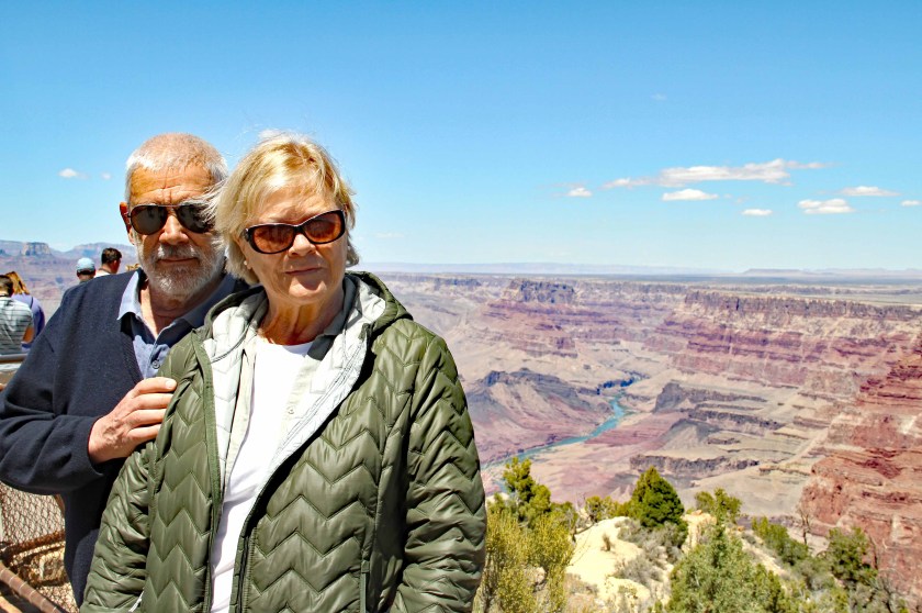
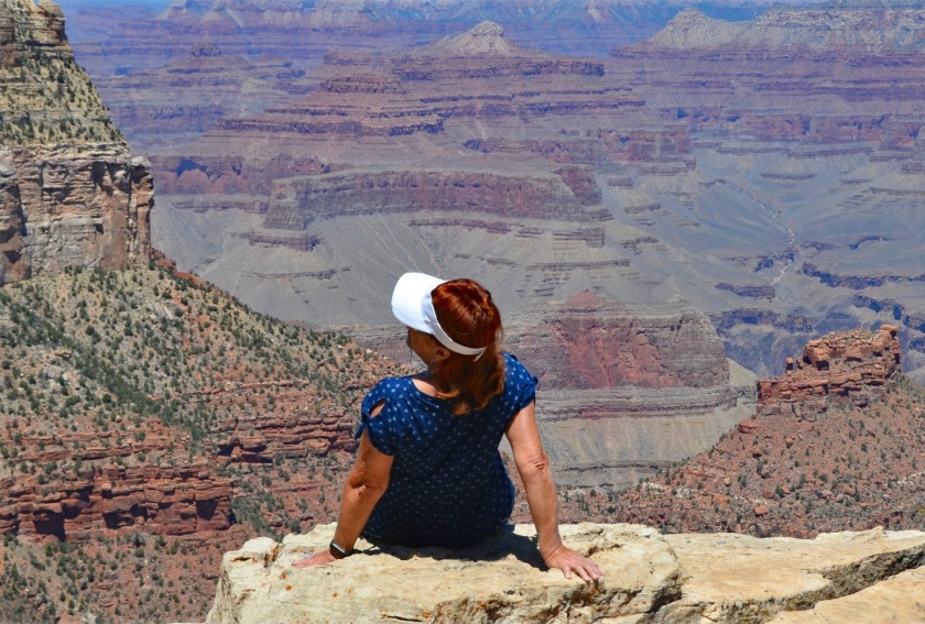
It was a humbling experience.  For anyone who is overly impressed with themselves or their worldly accomplishments, I suggest standing on the edge of the Grand Canyon.  It might serve to put things back into perspective.

1GCMap
The Grand Circle Route – Starting and ending in Las Vegas

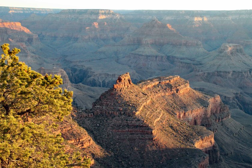
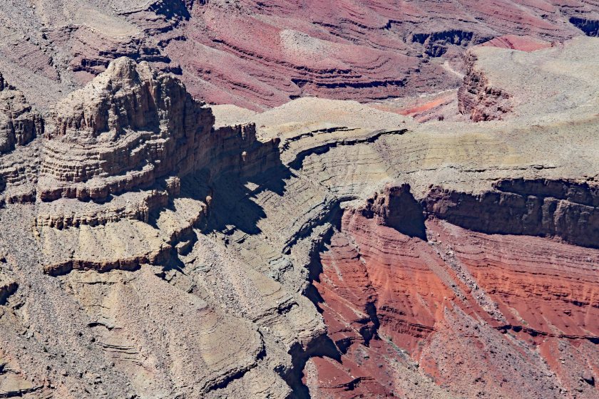
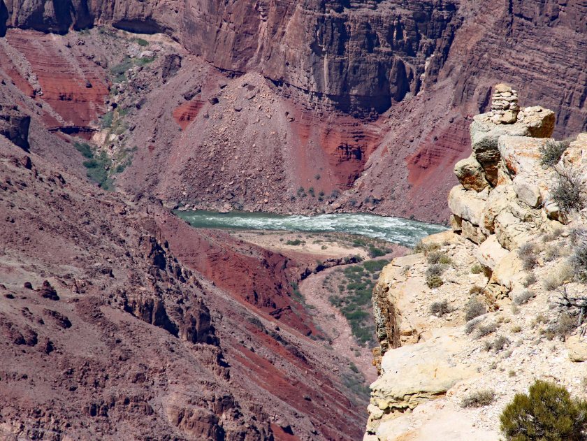
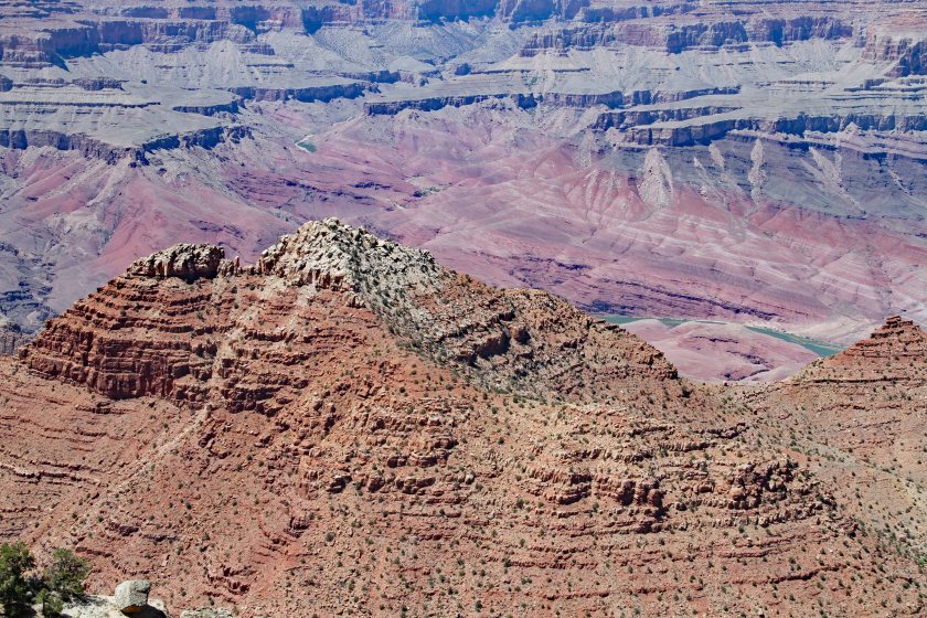
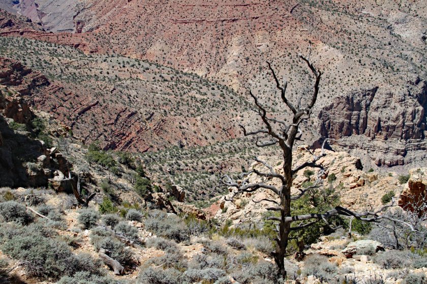
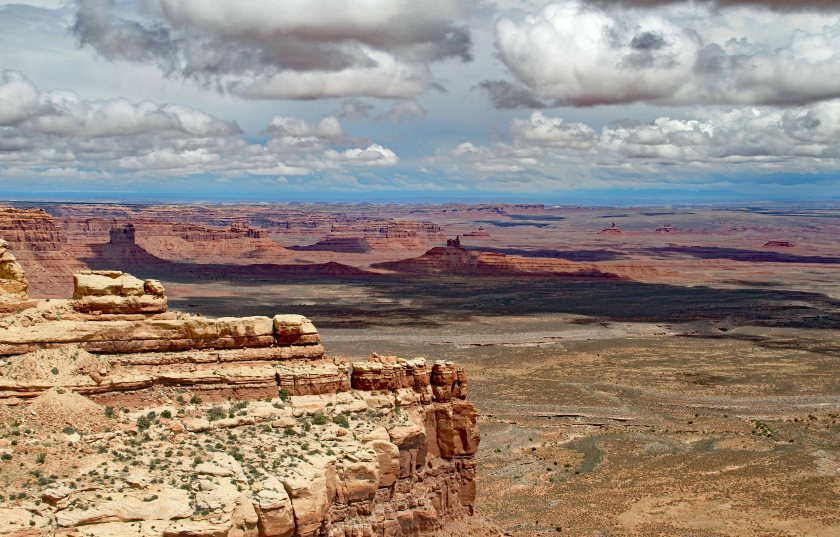
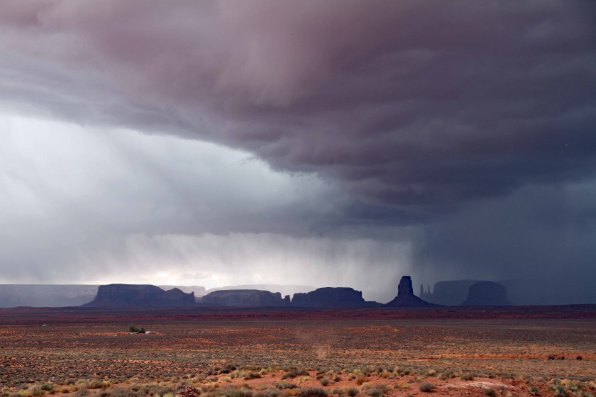
As we traveled in our trusty Kia Sedona, we were treated to a constant and ever-changing display of nature’s beauty.  The panoramas were dramatic and diverse and never failed to deliver unexpected surprises throughout the trip.  As the journey came to a close, a few thoughts came to mind:

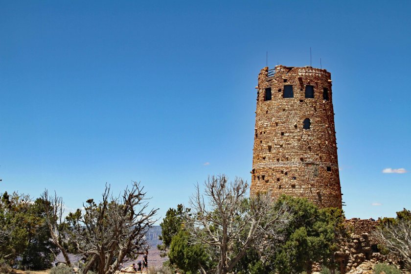
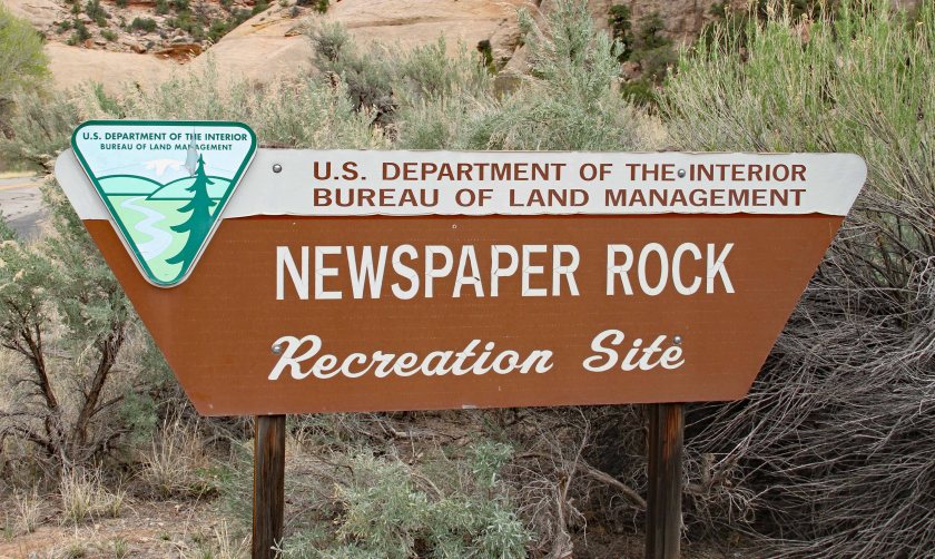
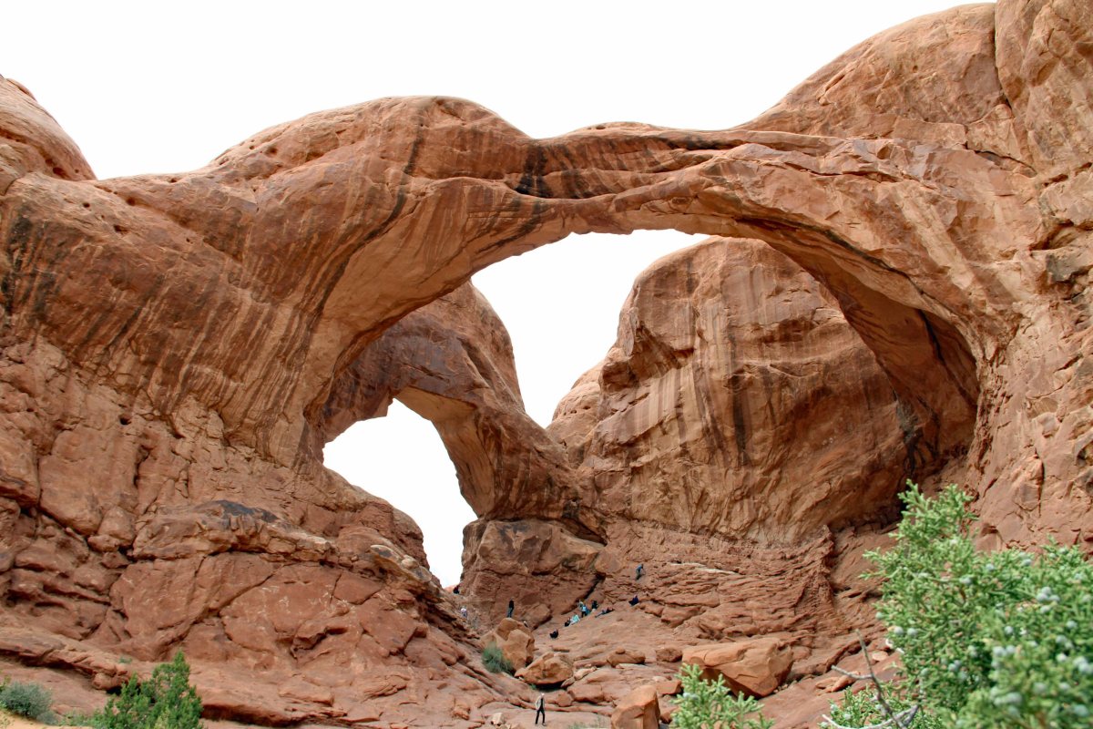
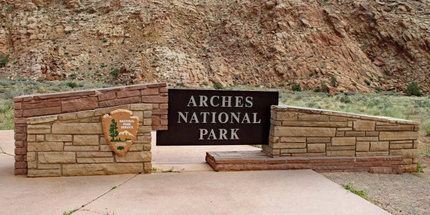
  • The U.S. system of national parks is an amazing treasure available to everyone – whether you are a U.S. citizen or not.  The National Park Service should be proud of the wonderful work it does today, as well as its long tradition of service.  The NPS has ensured that these natural wonders will be protected and preserved for future generations to enjoy.  Take advantage of it.  Consider an annual pass or a lifetime senior pass if your plans include multiple parks.  (Our passes paid off after three visits.)

Jan 9

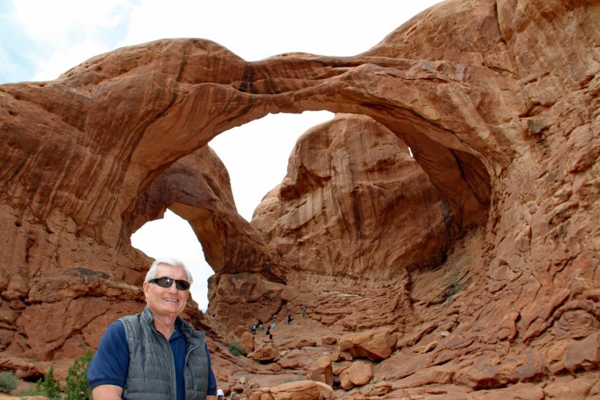
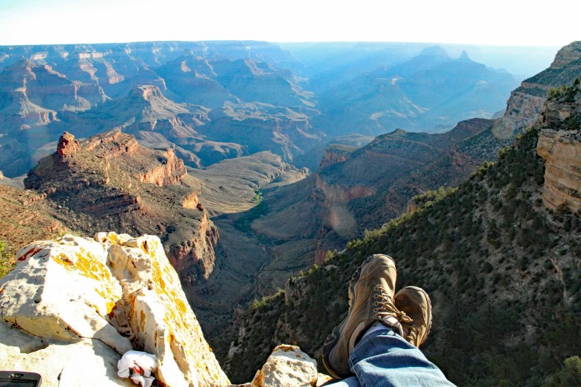
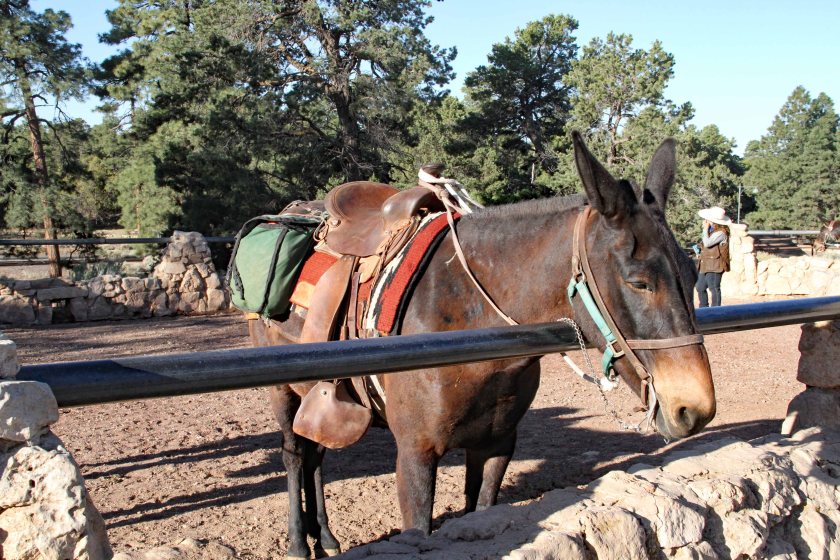
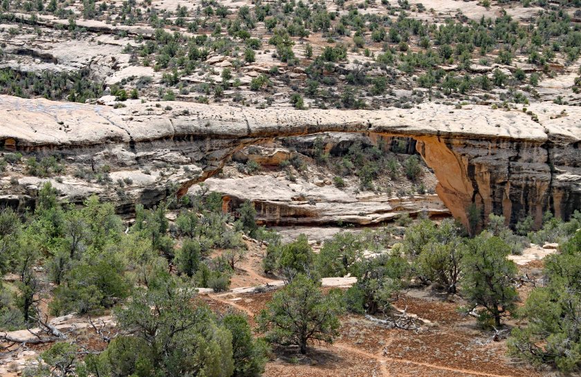
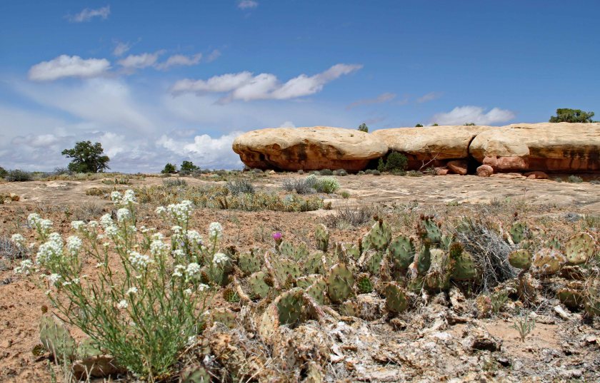
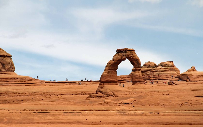
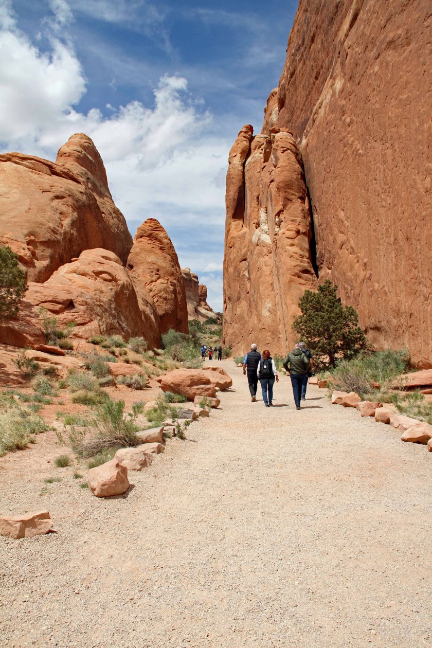
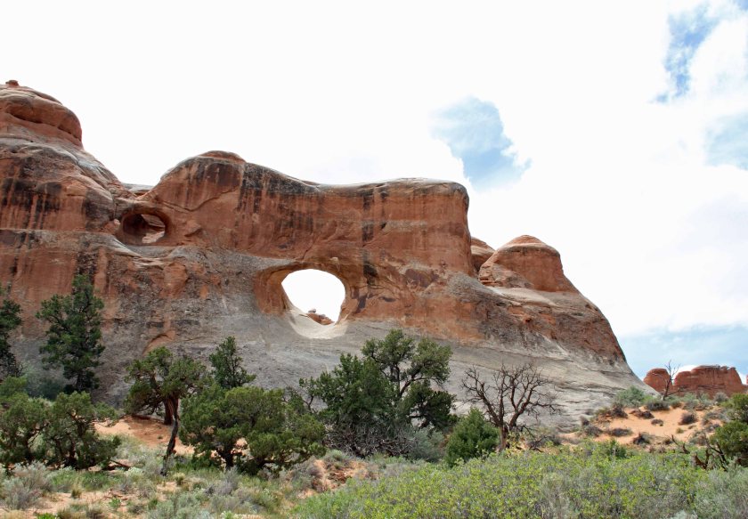
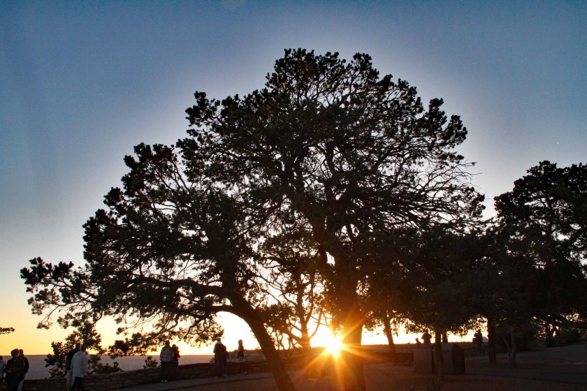
  • Our trip was definitely an “overview” trip.  We barely scratched the surface.  You could easily spend a week or more in each of the national parks and not run out of things to do.  The parks are vast areas with numerous hiking trails allowing closer inspection of sites, time permitting.  Staying multiple days in one park might allow you to catch that perfect sunrise or sunset or get up close and personal with your favorite arch or natural bridge.
3EIMG_7936
Sunrise over the Grand Canyon.
  • For our itinerary, traveling in the minivan and staying in hotels was the right choice.  Parking in the more popular parks at scenic overlooks was much easier than it would have been in an RV.  For a trip covering fewer parks and fewer miles, an RV might have been the right choice.


KIA
The Crew and our Kia minivan atop the Moki Dugway.


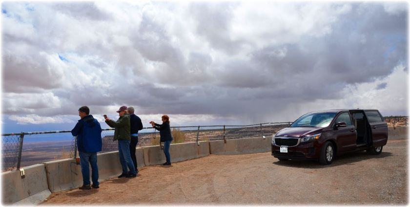
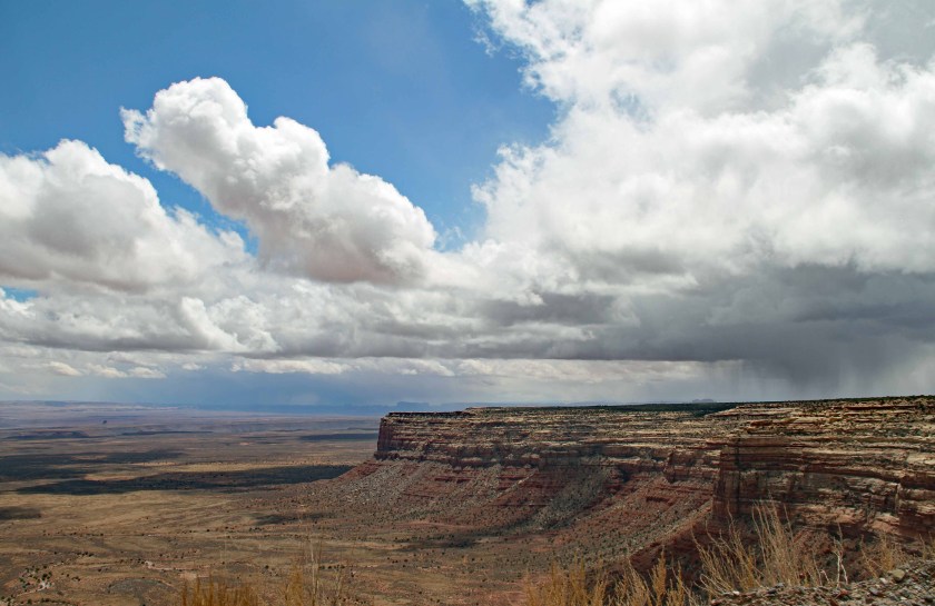
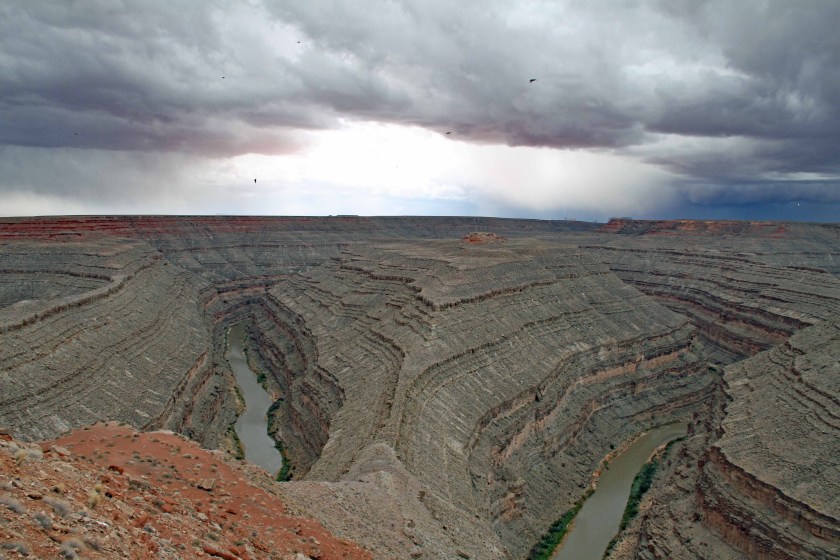
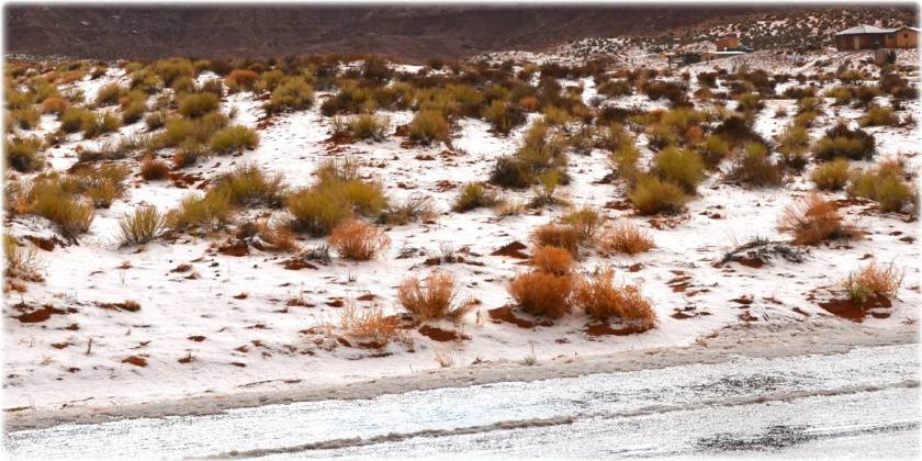
  • Being prepared for a flexible itinerary and changing weather conditions was a huge plus.  We carried small backpacks with us in case our “limited” hiking turned out to be not-so-limited.  We suggest carrying water, fruit, granola bars, trail mix, etc.  We also suggest having a fleece and a waterproof jacket.  We experienced warm and sunny days with temperatures in the 70s and 80s, but we also experienced snow and freezing rain with temperatures in the low 30s.
snow
Snow near the Utah-Arizona border.
4EIMG_7676
Threatening weather as we approached Monument Valley.


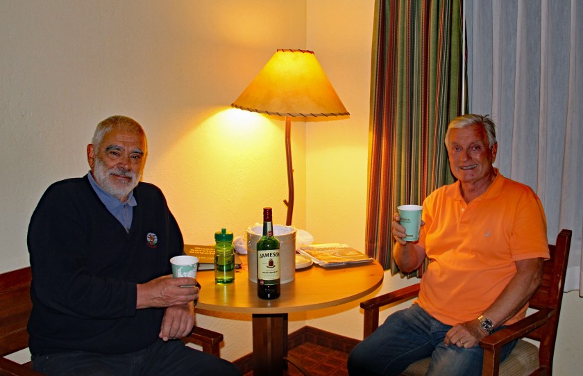
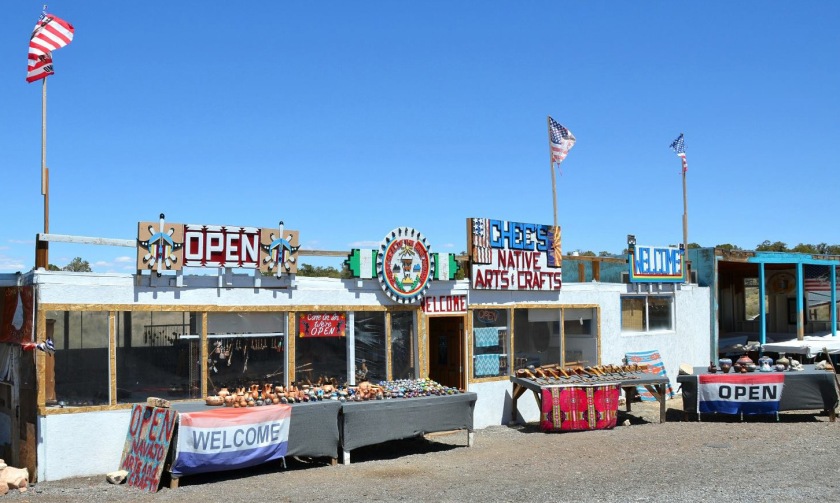
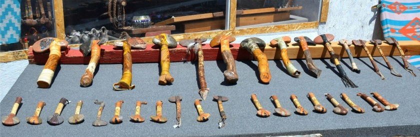
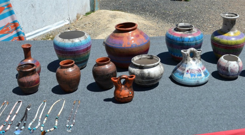
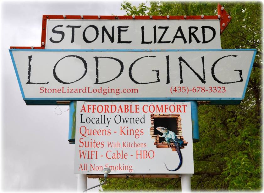
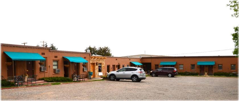
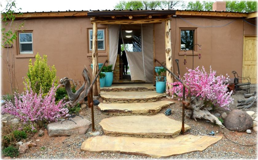
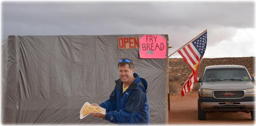
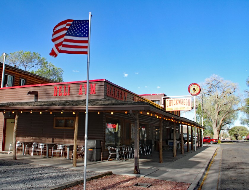
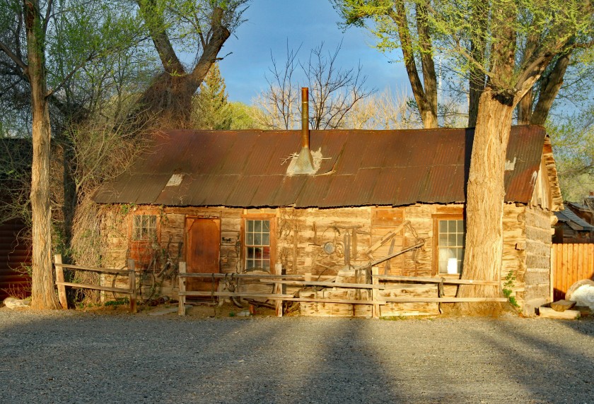
  • We really loved the mom-and-pop, family-owned businesses like Austin’s Chuck Wagon in Torrey, UT and the Stone Lizard Lodge in Blanding, UT.  They really went out of their way to make us feel like they appreciated our business.
EIMG_7338
Austin’s Chuck Wagon in Torrey, Utah.
EIMG_7340
Historic cabin at Austin’s Chuck Wagon.
Jan 1
No extra charge to watch the hummingbirds at the Stone Lizard Lodge in Blanding, UT.

In closing I would like to offer up these two extremely important tips:

  • Always close the hatch to the minivan securely to avoid launching flying duffel bags into oncoming traffic.
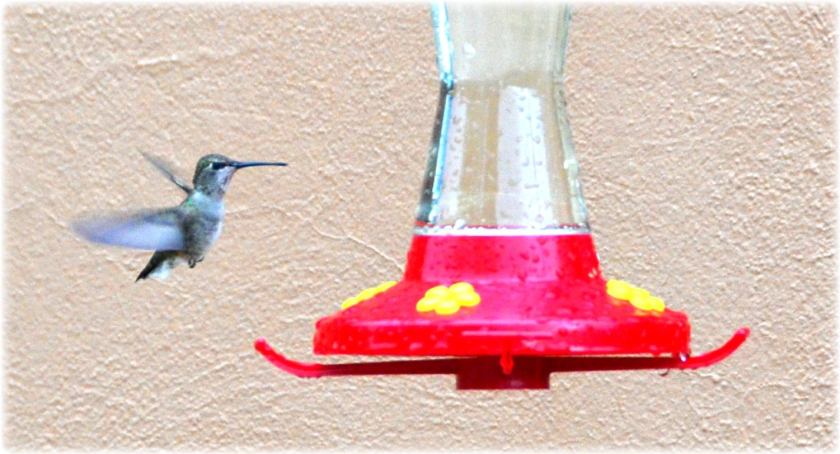
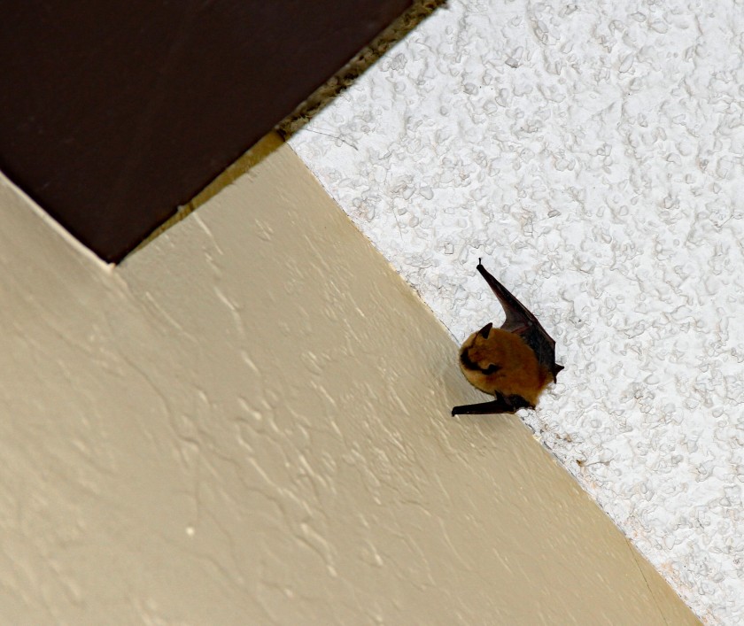
  • Always close the door behind you to prevent uninvited guests from joining the party.

EIMG_8032


This was my first attempt to document my travels in a blog format.  I hope you have enjoyed the photos and the commentary.  My hope is that this information will inspire others to travel to the American Southwest and assist them with their travel planning.  I always read and appreciate comments and suggestions.

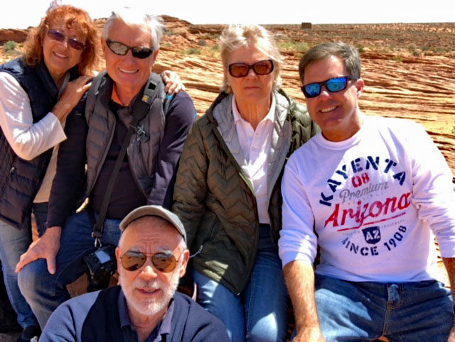
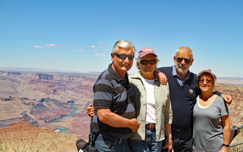
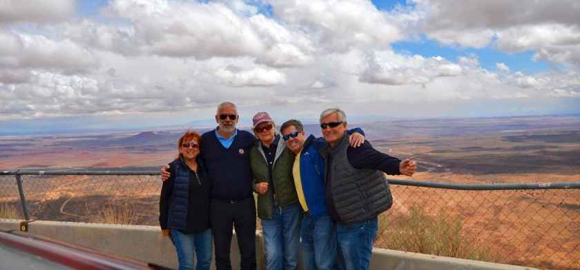
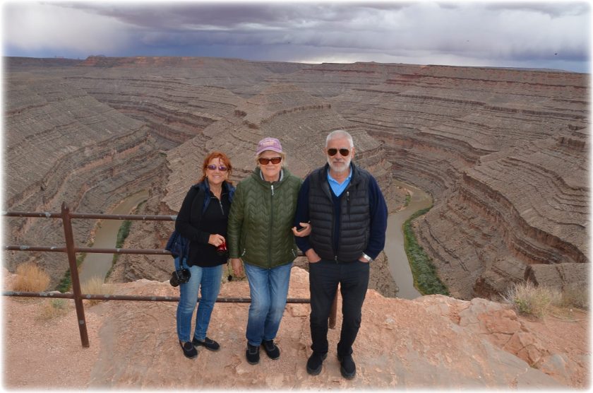
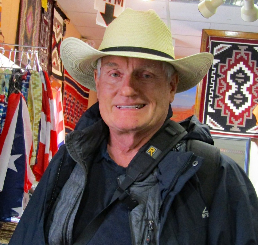
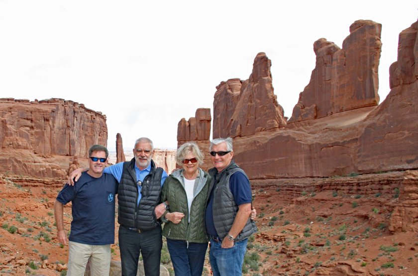
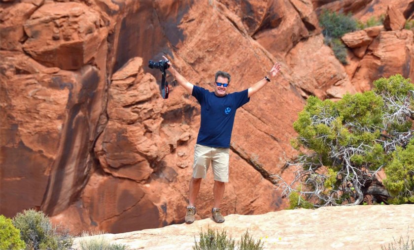
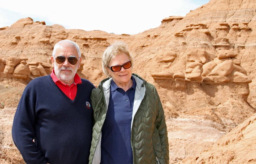
A huge thanks to Jan for planning and organizing the trip.  Many thanks to Dawne, Stefan and Ann for providing so much entertainment and so many laughs and memories along the way!

aCrew
The Crew


4EIMG_7524
Thanks, Jan!

The Grand Circle Tour – Day Ten (cont’d) – Nightcap With An Uninvited Guest

After an early dinner at the Maswik Lodge, we headed back to our rooms.  Stefan had started a nightly ritual of having a nightcap of Jameson Irish Whiskey while reflecting back upon on our day.  Since Ann was tired and Dawne had no interest in the whiskey, they headed to their rooms for the night.  The guys headed to my room for the nightcap.  I left the door open as I went to grab some ice on the first floor.  And that’s when it all went downhill…

Upon my return, I discovered that an uninvited guest had decided to join us.  A small brown bat had flown in through the open door and was now flying all around the room in panic mode.  He eventually settled high on the vaulted ceiling, hanging upside down near a heavy, wooden crossbeam.


EIMG_8032
Our uninvited guest


Jan found the situation quite humorous and sat in a chair chuckling nonstop, to the point that tears were rolling down his face.  The fact that the bat was in my room, and not his, appeared to be the major source of his amusement.  Jan, being the king of 20-20 hindsight, correctly pointed out that it probably wasn’t such a great idea to leave the door open.  I thanked him for his insight.

The three of us sat there clueless as to how to get the bat out of the room.  As we sipped our whiskey, talk of rabies and vampires did not help the situation.  I decided to call the front desk and ask for suggestions.  They agreed to send a porter.

As far as I can tell, the job of porter is a catch-all, entry-level position that involves any tasks that others are not assigned. The poor porter now found that bat removal had been added to his job description.  He showed up armed for battle with a four-and-a-half foot broom.  The short broom was obviously no match for the 16-foot high ceiling.  He quickly called for reinforcements.  A second man showed up with a giant dust mop attached to a long extension pole.  I began to suspect that these two had not completed their bat-removal training.

To their credit, the two porters were very concerned for the bat’s safety.  After all, the poor little bat had not harmed anyone.  Eventually, we decided to turn out the lights, hoping the bat would fly toward the light shining in through the open door.  After several attempts to coax the bat to fly with the encouragement of the dust mop, we were successful in getting him out the door and back into the night sky.

Crisis averted, we thanked the porters profusely and continued with our nightcap.  (Note to self:  It is always a good idea to close the door behind you.)

EIMG_8033

The Grand Circle Tour – Day Ten – Sunrise Over the Grand Canyon

I awoke at 4:30 a.m. to the sound of an alarm beeping.  Unfortunately, it was not my alarm.  It was an alarm belonging to one of my neighbors coming through the thin walls of the Mesquite Building at the Maswik Lodge.  It was still dark outside, so I decided to make the best of it and head to the edge of the canyon to catch the sunrise.  After a quick cup of coffee and a short wait for signs of first light, I headed toward the South Rim Trail.

I realized quickly that I was late to the party.  The trail was already dotted with visitors armed with cameras and smartphones – all were poised to capture the prize-winning photo.  Some were aiming their cameras in the direction of the sun, while others pointed in the opposite direction, waiting patiently for the sunlight to illuminate the east-facing canyon walls.

From one vantage point in front of the Hopi House, I noticed the sun’s rays peaking through a large tree, creating a beautiful silhouette.

3EIMG_79313EIMG_7932

3EIMG_7936
Look closely and you can see that I was not the only person up early to capture the sunrise.

To watch the sunrise at the Grand Canyon is truly something special.  I was humbled at the beauty before me that was on such a grand scale.  After all, this was the Grand Canyon.  As the sun rose, it crested rock formations to the east and began to bathe the canyon walls back to the west with warm rays of sunlight.  (This was the “Golden Hour” that photographers often reference.)

The light worked its way down gradually from top to bottom, eventually illuminating the canyon floor below.  The chatter from the visitors subsided as they stood in a trance-like state, watching the magnificent panorama before them.


1EIMG_79411EIMG_7942

1EIMG_7955
Mule deer enjoying the sunrise.

After a long while taking in the views before me, I grabbed a warm raspberry pastry and a coffee from the snack bar adjoining the Bright Angel Lodge.  I then found the perfect spot to enjoy my morning meal.  I sat on the edge of the canyon on a makeshift rock chair, with my feet dangling over the vast canyon below.  As I ate, I was joined by curious (and hungry) squirrels and chipmunks who were anxious to join me for breakfast.  What a glorious start to the day!

5EIMG_7989
Breakfast with a view!

1EIMG_79731EIMG_79741EIMG_79691EIMG_79801EIMG_7981

1EIMG_7984

As I headed back to the lodge, I passed a pen where the mules were being readied for the trip down to the bottom of the canyon.  I spoke to one of the mule handlers and he said that it would be a ten hour trip – five hours down and a five hours up.  Stefan had inquired about doing the trip, but it was fully booked during our stay.

5EIMG_80575EIMG_80595EIMG_7993

5EIMG_8055
I stopped to talk to this guy, who was a visitor about to embark on the mule ride to the bottom of the canyon.  He was decked out with a cool, patriotic cowboy hat, complete with a GoPro, ready for action.


Sunrise Day Two

Dawne and I did a repeat of the sunrise routine on the next day.  The sunrise was very beautiful, but it was also very different.  On the second day, there were many more clouds in the sky, that resulted in beautiful colors as the sun rose and its rays were refracted by the clouds.

2EIMG_8034

2EIMG_8039
Silhouette of the El Tovar Hotel.

2EIMG_80402EIMG_8043


1GC Breakfast
Breakfast with a view on the second day.


The Grand Circle Tour – Day Nine – The Grand Canyon

After a nice buffet breakfast at the Best Western in Page, AZ, we headed out toward the Grand Canyon.  We stopped at a roadside stand to check out some Native American crafts (pottery, jewelry, tomahawks, etc.) along the way.

Jan 5Jan 6Jan 7

We reached the Grand Canyon via the Desert View Entrance Station, which is at the eastern end of the south rim.  We stopped at the Desert View Watchtower and were treated to our first glimpse of the massive canyon.

1EIMG_78281EIMG_78292EIMG_7853

Before us was panorama that was on a scale like nothing we had experienced on our trip to date.  A sign titled “Edge of Vastness” indicated that the canyon was one mile deep, 18 miles wide and 277 river miles long.  It was hard to comprehend the enormity of the landscape in front of us.


2EIMG_7857
The Crew with the Colorado River and the massive canyon in the distance.


2EIMG_78692EIMG_78662EIMG_78652EIMG_7862

2EIMG_7861
Close-up of a section of rapids.

2EIMG_78551EIMG_78401EIMG_7839

4EIMG_8025
Look closely and you can see a bridge that spans the river.

4EIMG_8018


1EIMG_7842

After checking out the views from several other vantage points along the way, we headed to the Maswik Lodge to check in.  The Lodge is actually a collection of two-story buildings with guest rooms that are grouped around a central building.  The main building houses the reception area, a gift shop, and a cafeteria-style restaurant. We were assigned to the Mesquite Building.  The rooms were a bit rustic and basic, but were clean and well-equipped.  The location was excellent, with access to the South Rim Trail only a short walk away.

Jan 13

Jan 12
The Mesquite Building within the Maswik Lodge complex.


We settled into our rooms and then headed along the path to check out more amazing views of the canyon.  We passed several shops, galleries, and lodges as we walked along the South Rim Trail.  Of all the national parks we had visited, the Grand Canyon was definitely more well-equipped, with facilities and amenities to accommodate visitors at every turn.


3EIMG_8003
A park ranger explained that this heart-shaped rock, known as Matrimony Rock, was probably placed in the wall around 1934.  Legend has it that a young man, working for the CCC (Civilian Conservation Corps), placed it in the wall to honor his beloved, who was probably a young lady working a concession job at the park.  The rock is between Kachina Lodge and El Tovar Hotel.


Below are some photos of some of the wildlife along the south rim.

2EIMG_78582EIMG_7847

2EIMG_7851
Friendly raven looking for a handout.
4EIMG_8016
A buzzard soaring overhead.


3EIMG_7889
Mule deer were grazing all along the South Rim Trail.  They appeared to be extremely tame, but we were warned to keep our distance.


Jan 11Jan 8

4EIMG_8028

We ended up in front the El Tovar Hotel, which is the premier lodging facility within the park.  Built in 1905, it is listed on the National Register of Historic Places and has hosted U.S. presidents and other dignitaries over the years.  We decided to have an early dinner at the restaurant and the staff did not seem to mind that I was wearing a T-shirt and shorts.  This was definitely the best meal of our trip.  Jan opted for the sea bass entrée, while the rest of us decided to mix it up with various salads and appetizers.  The seared sea scallops were perfectly cooked and delicious.  At the end of the meal, we were all tempted by their wonderful selection of desserts.

3EIMG_7961
The front entrance to the El Tovar Hotel
3EIMG_7908
Rear view of the El Tovar Hotel

3EIMG_7880

3EIMG_7879
The El Tovar Hotel occupies some prime real estate on the south rim and affords visitors amazing views.

Feeling content after a wonderful meal, we headed back to our rooms and called it a night.


The Grand Circle Tour – Day Eight (Part 2) – Antelope Canyon

There are several companies that offer tours of Antelope Canyon in and around the town of Page, AZ.  We booked a 5:00 p.m. tour with Antelope Slot Canyon Tours for the upper canyon through the Visitor Center.  We drove a few blocks from our hotel to the pickup location for the 4:30 check in.  The tour was scheduled to take 90 minutes.

We were instructed to board trucks that had been specifically modified to transport people to the entrance of the canyon.  The truck beds contained two rows of back-to-back benches that were arranged parallel to our direction of transport.  Each bench had space for six people, while two lucky people were allowed to sit in the cab with the driver.  Jan, Dawne and I were assigned to truck #2, while Stefan and Ann were assigned to truck #6.


1EIMG_7744
Our transport vehicle


We left for the 15 – 20 minute trip to the canyon and the paved road turned into a bumpy and dusty dirt road.  People began to hang on for dear life and I began to question the decision to forgo the use of a seatbelt.  When we arrived at the site, we found ourselves coated with a thin layer of red dust.

Antelope Canyon is actually a pair of slot canyons.  The upper canyon is nicknamed “The Crack” and the lower canyon is nicknamed “The Corkscrew.”  Access to the canyons is strictly controlled by the Navajo Nation, since the site is on their land.  To view the canyons, you must participate in a guided tour.

1EIMG_77481EIMG_77491EIMG_77511EIMG_7752

1EIMG_7753
This was nicknamed The Baby Elephant.

1EIMG_77541EIMG_77571EIMG_7759


Our guide for group #2 was Earnest Yellow Horse, who was very personable and entertaining.  He pointed out distinctive rock features along the way – some were nicknamed after U.S. presidents, while others were nicknamed after animals.  Earnest was the master photographer, with a keen sense for finding just the right angle to capture the light perfectly.  Photography was difficult in the low-light conditions and tripods were strictly prohibited.  Earnest offered to take pictures for guests using their cameras and smartphones.  As it turned out, our best shots were taken by him.


EIMG_7822
Jan with Earnest Yellow Horse.
EIMG_7820
Ann enjoying the tour.
EIMG_7819
Stefan with the guide from group #6.


I suspected that this must have been a very sacred place, where the Navajo people had been visiting for hundreds of years.  However, Earnest explained that the canyon was only discovered in the 1950s by a young girl tending sheep.  After many of her flock went missing, she finally found them huddled inside the cool canyon walls.

2EIMG_7762

2EIMG_7763
I believe this was nicknamed King Kong.

2EIMG_77682EIMG_7769

2EIMG_7776
This was nicknamed The Bear.  Look closely and you can spot the raised arms of a bear looking up  toward the opening of the canyon.

2EIMG_7779

2EIMG_7784
I believe this was nicknamed George Washington.
2EIMG_7787
This is my favorite photo and it was taken by our guide.  If you look closely, you can spot the namesake antelope in the middle of the shot on the left wall.  If you use your imagination, you can see a smaller one just above it on the right wall.

2EIMG_77892EIMG_7801


The canyons were formed by the erosion of Navajo sandstone and are still impacted by flash flooding today during monsoon season.  We learned of the tragic story that occurred on August 12, 1997.  Eleven tourists from France, the UK, Sweden, and the U.S. were killed in Lower Antelope Canyon by a flash flood.  A distant thunderstorm had dumped a large amount of rain into the canyon basin over seven miles away.  The water was then funneled toward the site and then ripped through the lower canyon, washing the tourists and their guide away.  The lone survivor of the flood was tour guide Francisco “Pancho” Quintana, who had prior swift-water training.

Thankfully, we were transported safely back to town.  We were covered in red canyon dust, but were none the worse for wear.

The Grand Circle Tour – Day Eight (Part 1) – Horseshoe Bend and the Chinese Tourist Invasion

Our plan for the day was to drive from Kayenta to the town of Page, with stops along the way to check out a couple of popular sites.

We stopped on the road into Page at a company offering tours of Antelope Canyon and found out that all tours were booked until at least 4:00 p.m.  Apparently the tours were more popular than we realized, so we decided to head to Horseshoe Bend and save the canyon for later.

Horseshoe Bend is a massive horseshoe-shaped meander in the Colorado River.  It is located five miles downstream from the Glen Canyon Dam and Lake Powell, within the Glen Canyon National Recreation Area.  It is about four miles southwest of Page and can be viewed from the steep cliffs overlooking the 1,000-foot drop to the river below.  It is the ultimate Kodak Picture Spot.


1EIMG_7710
The iconic Horseshoe Bend


EIMG_7731EJan 2

EJan 4
The ever-cautious Jan approaches the edge to snap some photos.

IMG_7719


EJan 3

The place was an absolute zoo, with a steady stream of cars and buses vying for open parking spots vacated by those leaving.  Statistically speaking, you are probably more likely to die after being run over by an irate Chinese bus driver, weaving his way backward through oncoming traffic, than you are by falling to your death off of the steep cliffs.  We witnessed one such bus driver making slow, backward progress, while honking and occasionally jumping out to scream and shake his fist at the other drivers.

After successfully finding a parking spot, we started the short hike to the edge of the rim. As we crested the first hill, we saw a sea of people that resembled a line of marching ants traveling to and from the rim.  Again, this spot was more popular than we anticipated. Based on the banter we heard, the majority of visitors were foreign and appeared to be overwhelmingly Chinese – probably day trippers staying in other locations.  We could not imagine what visiting would be like in the heat of the summer with the crush of high-season tourists.

EJan 1
The Crew about to start the short hike to the edge of Horseshoe Bend.
EIMG_7701
Steady stream of tourists heading to and from the rim.
2EIMG_7727
Tourists crowd the edge of the rim – the ultimate selfie spot.

The minor delays and frustrations were definitely worth enduring, because the views were absolutely stunning.  We walked along the rim and witnessed the beautiful, emerald-green river winding through the bend below.  We also spotted a few inflatable boats in the river, possibly carrying groups of Chinese tourists.

1EIMG_7723EIMG_7714

The views from the edge were not for the faint of heart.  Peering over the edge was made even more nerve-racking by the lack of any guard rails.  This is another spot where pictures do not do it justice and you cannot capture the entire bend unless you have a wide-angle lens.

This sizeable section of rock really intrigued me.  It had cleaved away from the edge of the rim and was hanging precariously over the edge.  It would eventually fall to the river below.  That might happen tomorrow or that might happen in a thousand years.  It occurred to me that the many visitors crawling out to the edge of the rock to capture that perfect photo were oblivious to this fact.


2EIMG_7726.jpg
Taking bets – When will it fall?


As we were leaving, we were in for one final burst of excitement.  The hatch to our minivan popped open, launching Jan’s duffel bag out of the back and depositing it onto the dusty, dirt road.  I sprang from the vehicle and sprinted about 200 feet to retrieve the bag, thinking it was in imminent danger of being mangled by an irate Chinese bus driver.  Several bystanders were kind enough to point out that we had lost a suitcase as I ran past, huffing and puffing.  Once back in the vehicle with the bag, Jan was surprisingly calm.  He did quietly point out that it was probably my fault for not properly closing the hatch.  Although the conversation quickly turned to other subjects, I suspected that this was not the last I would hear of this incident.

SAD POSTSCRIPT:  A few days after our trip ended and we were safely back home, we learned that a 33-year old man from Phoenix fell to his death at Horseshoe Bend.  

The Grand Circle Tour – Day Seven – Goodbye, Utah – Hello, Arizona (Mother Nature Takes Center Stage)

We awoke to overcast skies and occasional light rain in Blanding, Utah.  We were staying at the quirky Stone Lizard Lodge, which turned out to be a great place.  At first glance, it did not look like it had much to recommend it.  It appeared to be a non-descript, single-story motel on the side of the road, with parking directly in front of the rooms.

As it turned out, we really enjoyed our stay.  I love mom-and-pop type places that really go that extra step to show you that they appreciate your business.  There was a nice, well-maintained garden out back where guests could sit and relax.  We also noticed several bird feeders around the property that were successfully attracting swallows and hummingbirds.  The simple rooms were immaculately clean and were even decorated with some local art.  My room was a whopping $115 per night.

Jan 55 - Copy

Jan 77 - Copy
Front of the Stone Lizard Lodge
Jan 88 - Copy
Entrance to common room where breakfast was served.
Jan 1
Hummingbird feeding on the front side of the property.


We started out the day with a hearty breakfast, consisting of homemade sweet and savory pastries as well as several other offerings.  We could not help but meet several other hotel guests due to their close proximity at the very compact group table.  Everyone was very pleasant and eager to share their travel stories and recommendations.  I think I spotted Stefan stealing food off another guest’s plate, but I was not entirely sure.

We were anxious to explore southern Utah after visiting the wonderful visitor center in Blanding the day before.  A very friendly and knowledgeable lady had provided us with several brochures and more than enough options to fill our day.  She was obviously very proud of her state and all that it had to offer.

Mother Nature Takes Center Stage

Our overall plan was to head south towards Arizona and hit several sights along the way.  As we drove, the altitude increased and the temperature continued to drop.  Rain turned to sleet and then to snow, with some fog mixed in for good measure.  Not exactly the weather we expected in May, but we pressed on.  We spotted several cows and calves along the way and had to slow down a few times to avoid hitting them as they wandered into the road.


1EIMG_7623
Calf on the side of the road.

Natural Bridges National Monument

After an unplanned detour to the town of Hite to get gas, our first stop was Natural Bridges National Monument.  It is not an official national park, but it is run by the National Park Service, so our annual park pass covered the admission.  An eight-mile loop runs through the park with viewpoints along the way to see Sipapu, Kachina, and Owachomo natural bridges.  We didn’t see much of Kachina, because Mother Nature was pelting us with sleet and rain, but she did allow us fantastic views of the other two bridges.  Before leaving the park, we stopped at the visitor center to view a short film about the history and geology of the park.


1EIMG_7632
Sipapu Natural Bridge
1EIMG_7633
Sipapu is the youngest (and thickest) of the three natural bridges in the park.
1EIMG_7636
Close-up of Sipapu Natural Bridge


1EIMG_7641
Owachomo Natural Bridge – the oldest (and thinnest) of the three bridges.
1EIMG_7642
Close-up of Owachomo Natural Bridge.


We ran into some hard-core travelers having lunch in the parking lot of the visitor center.  We were intrigued by their van, which had a customized extension that doubled as a table and a storage bin.


1EIMG_7648
Stefan bonding with our new friends, who were enjoying a stand-up lunch.

The Moki Dugway

We then headed south on SR-261 in search of the Moki Dugway.  Once again, we found that the journey was part of the entertainment.  The paved road turned into a three-mile stretch of gravel switchbacks with an 11% grade.  We suggest you find another route if you have a fear of heights.  However, the narrow road afforded sweeping views of the Valley of the Gods and the distant Monument Valley.  It was originally built in the 1950’s as a mining transport route.


2EIMG_7649
A distant rain shower viewed from atop the Moki Dugway.
2EIMG_7656
View across to the Valley of the Gods.
2EIMG_7657
The winding switchbacks leading back to the paved road.
2Jan 3
The Crew atop the Moki Dugway.

2Jan 5

2EIMG_7659
Back on the pavement and heading south.

Goosenecks State Park

Next up, we hit Goosenecks State Park, which allows a panoramic view of the meandering San Juan River 1,000 feet below.  The desert landscape reveals 300 million years of geological activity.  The lighting was not the best for photography, but we could not help but be impressed by the awe-inspiring views.  We were surprised at the scarcity of guardrails as we peered cautiously over the edge.  We thought it was a great value for the $5 entrance fee.

3EIMG_7666

Jan 7
Dawne, Ann and Stefan and one of the rare guard rails at the park.

3EIMG_76673EIMG_7670

Monument Valley

Our final area to explore was Monument Valley, made world-famous by the many western-themed movies filmed there.  We grabbed an order of the local specialty, fry bread, from a road-side stand and snacked on that as we drove through the flat terrain.

Jan 9

All around us, the landscape was dotted with imposing monolithic red rocks (monuments).  The valley is the perfect area to sharpen your landscape photography skills.  Again, the weather was not cooperating fully.


4EIMG_7674
Mexican Hat Rock just outside of the town of Mexican Hat
4EIMG_7676
Approaching Monument Valley.

4EIMG_7678

4EIMG_7679
Ominous weather looming in the distance.

4EIMG_76884EIMG_76924EIMG_7699

Goulding’s Lodge and Trading Post

We also stopped at the Goulding’s Lodge and Trading Post, but decided that the touristy place was not on our list of favorites.  We did find the original cabin from the John Wayne film “She Wore A Yellow Ribbon,” which is free and open to the public.  (You can complete the cabin tour in approximately three minutes.)

EIMG_7681

4EIMG_7684
Original cabin used in the John Wayne film “She Wore A Yellow Ribbon.”
eJan 11
Swedish Cowboy spotted in the gift shop at Goulding’s.


After a full day, we crossed into Arizona and checked into the Kayenta Monument Valley Inn.

The Grand Circle Tour – Day Six – Canyonlands National Park

As we left Moab, our plans for the day were very fluid.  We headed south in the general direction of Blanding, UT and were on the lookout for anything that piqued our interest.  Dawne was busy researching online (when she had cellular coverage) and the rest of the crew were reading road signs and scouring through any brochures we had on hand.  We didn’t have to wait long – only 24 miles into our journey, we spotted our first target.

Wilson Arch

After getting our fill of arches at Arches the day before, Utah added in one more for good measure.  Driving south on UT-191 we came across Wilson Arch, which is visible directly from the road.  It is named for Joe Wilson, who was an early pioneer who had a cabin in nearby Dry Valley.


1EIMG_7527
Wilson Arch
1EIMG_7528
Close-up of Wilson Arch for some perspective on its size.


We were a bit disappointed that we would have to forgo visiting Dead Horse Point State Park and Canyonlands National Park – or so we thought.  We had passed entrances to these sites north of Moab and assumed our chance to visit on this trip was lost.  We were pleasantly surprised when we saw signs for access to Canyonlands and Newspaper Rock via UT-211.

Newspaper Rock

We made a quick stop at Newspaper Rock, which is a collection of petroglyphs dating back over 2,000 years.  We learned that petroglyphs are images created by removing the surface of the rock by carving or engraving.  In this case the rock has a dark exterior coating.  Apparently the locals have been stopping by for thousands of years to catch up on the “latest” news.

1EIMG_75301EIMG_75341EIMG_7535

Canyonlands

Canyonlands is a vast National Park covering 527 square miles and is less frequented by visitors than other national parks – probably because its roads are mainly unpaved and its trails are more primitive.  There are two entrances and we were fortunate to stumble upon the southeast entrance.  The confluence of the Green and Colorado Rivers is located within the park, but is accessible only by four-wheel drive vehicles.

We made stops at Wooden Shoe Arch Overlook and Pothole Point. The vistas were amazing as we scanned across multiple canyons and intriguing rock formations.

5Jan9
Wooden Shoe Arch
3EIMG_7574
Needles District in the background.
4Jan 2
Close-up of the Needles District.

4Jan 13EIMG_75773EIMG_75723EIMG_75703EIMG_75985Jan 104Jan 34Jan 45EIMG_7560

We were particularly impressed with the variety of colorful plant life.

1EIMG_75551EIMG_75621EIMG_75641EIMG_75651EIMG_75811EIMG_75901EIMG_75921EIMG_7597

1EIMG_75475EIMG_7586

Apparently, the park is home to a wide variety of wildlife (bighorn sheep, coyotes, etc.), but we were only lucky enough to spot several lizards and one very friendly raven.

1raven2EIMG_7550

Utah’s Mighty Five

As an added bonus, we realized that we had now completed the list of Utah’s Mighty Five, comprised of Zion, Bryce, Capitol Reef, Arches and Canyonlands National Parks.  We were so proud!

The Grand Circle Tour – Day Five – Arches National Park

We left Green River for the short drive to Arches and quickly found out that we were not the only ones that had decided to visit the park that day.  We waited in line for about 45 minutes before gaining access through the entrance station.  (Note to self:  Arrive before 9:00 a.m. to avoid the lines.)  We suspected our day exploring the park would be worth the wait and we were definitely not disappointed.  It was loaded with so many check-the-box photo opportunities.

1IMG_7376.jpg

The park is home to over 2,000 natural sandstone arches, in addition to a variety of unique geological formations.  It contains the highest density of natural arches in the world.

EJan 4
Stefan and Ann strike a pose at the Park Avenue Viewpoint.
4EIMG_7515
Elephant Butte

2EIMG_74592EIMG_74482EIMG_7454

1EIMG_7393
Quick group photo at our first stop – the Park Avenue Viewpoint.


With so much to see and do, we decided the best approach was to use our vehicle and hit as many scenic overlooks as possible.  The layout of the park involves a long, winding road from the entrance station to the Devil’s Garden with a couple of spurs along the way.  There are numerous hiking trails to explore to gain closer access to sites, but our schedule limited our opportunity for hiking.

As we toured the park, we were constantly in awe of Mother Nature’s beauty.  The arches and rock formations were spectacular.


1EIMG_7381
Queen Nefertiti’s Head

1EIMG_73861EIMG_7394


1EIMG_7399
The Three Gossips can be spotted near the center of the photo in the background.
1EIMG_7406
Balanced Rock from a distance.

1EIMG_7410


1EIMG_7416
Close-up of Balanced Rock

1EIMG_7435


Highlights of our tour included the iconic Delicate, Landscape and Double Arches.

2EIMG_7438

2EIMG_7440
Delicate Arch – Notice people hiking around the base for some perspective on its size.

2EIMG_7452

2EIMG_7456
Skyline Arch

2EIMG_74602EIMG_7463

2EIMG_7464
Another view of Skyline Arch.
2EIMG_7467
Gnarled tree near Skyline Arch.


We were also impressed with the diversity of plant life in the high desert.  We saw red, orange, yellow, purple and white flowering plants along the way and an abundance of gnarled evergreen trees and cacti.

3EIMG_74683EIMG_7470

3EIMG_7473
The trail to Landscape, Pine Tree and Tunnel Arches.
3EIMG_7481
Tunnel Arch

3EIMG_7483


3EIMG_7488
Pine Tree Arch


3EIMG_7489
Pine Tree Arch from another angle.

3EIMG_7494

3EIMG_7501
Landscape Arch

3EIMG_7502

We barely put a dent on the list of 2,000 arches, but managed to have an amazing day.

4EIMG_7509

4EIMG_7520
Approaching Double Arch.
4EIMG_7521
This reminded us of the Sphinx.
4EIMG_7523
Double Arch – Again, spot people hiking in the center of the photo for some perspective.  It really was massive.

4EIMG_7524EJan 1

EJan 2
Jan and Dawne in front of Landscape Arch.

EJan 3

EJan 5
Doing my best impression of Balanced Rock.


The Grand Circle Tour – Day Four – Goblin Valley State Park and Green River, Utah

As we left Torrey, we did not have a nailed-down plan for the day.  We headed toward Green River, UT on SR-24 and were on the lookout for interesting places to investigate.  As we crossed a very desolate area of high desert, we saw signs for Goblin Valley State Park and decided to check it out.

Jan 8
Did I mention that the area was desolate?!?

Utah once again had an unexpected surprise for us.  Goblin Valley is a series of five buttes and a valley of strange-shaped rock formations (goblins) surrounded by a wall of eroded cliffs.  The park brochure explains that the area was sculpted by forces of nature acting on deposits of Entrada sandstone laid down 170 million years ago by a vast inland sea.  Some goblins resemble trolls or garden gnomes, while others look like mushrooms.  We even spotted one that resembled Steven Spielberg’s E.T.

EJan 3EJan 41EIMG_7356EJan 2

EJan 1
Dawne making her way down into the valley.

Rich Rock Head1EIMG_73651EIMG_73621EIMG_7360

1EIMG_7366
Stefan very carefully balances a rock on his head.

EJan 7

EJan 6
This goblin was an E.T. look-alike.

1EIMG_73591EIMG_73551EIMG_73511EIMG_73501EIMG_73491EIMG_7348

1EIMG_7345
A series of troll-like goblins.

1EIMG_73461EIMG_7344

After spending time with the goblins, we headed on to Green River.  Our options for entertainment were limited in the sprawling metropolis (population 943), so we decided to check out the John Wesley Powell River History Museum.

john-wesley-powell-river

We were intrigued as we learned the story of Powell and his band of frontiersmen, who embarked on an expedition down the Green and Colorado Rivers to study and document the previously-unexplored region.  We watched a short film, which chronicled their journey.  As they travelled down the rivers in wooden boats in 1869, they experienced a series of hardships, including the loss of boats and supplies, near-drownings and the departure of some crew.

Particularly impressive was the fact that Powell survived the expedition through the rugged territory with only one arm.  His right arm was amputated below the elbow after being wounded by a musket ball in the Battle of Shiloh in the Civil War.  Also intriguing was the fact that three of the men, who abandoned the journey prior to a particularly-treacherous stretch of rapids, were never seen or heard from again.

We struggled to put our evening happy hour together at the River Terrace Inn.  We found ourselves eating two-toned, plastic-tasting cheese that was purchased from the mini mart of a local gas station – not exactly our best effort.  However, all was not lost as we found great burgers and a very friendly server at Ray’s Tavern.

ERay's Tavern.jpg