The Grand Circle Tour – Day Six – Canyonlands National Park

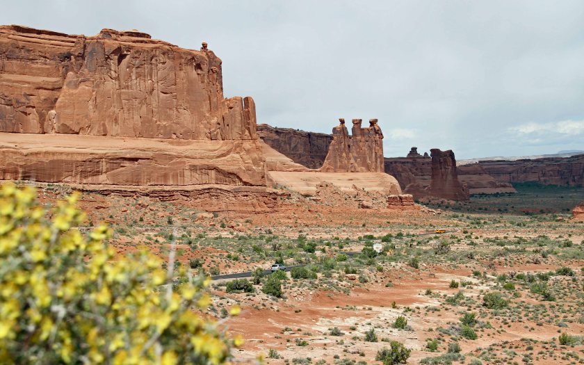
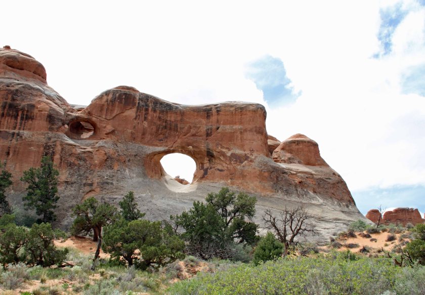
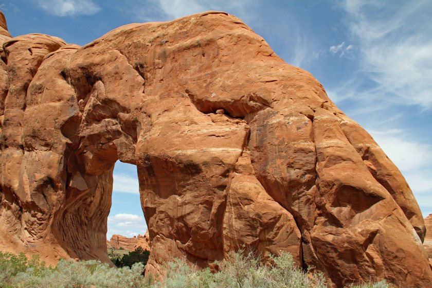
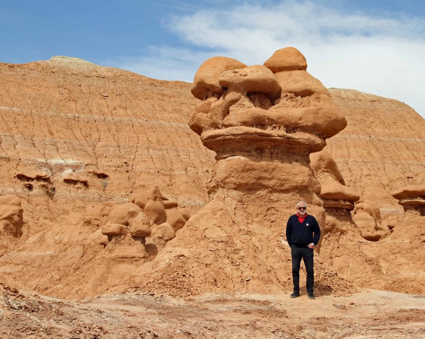
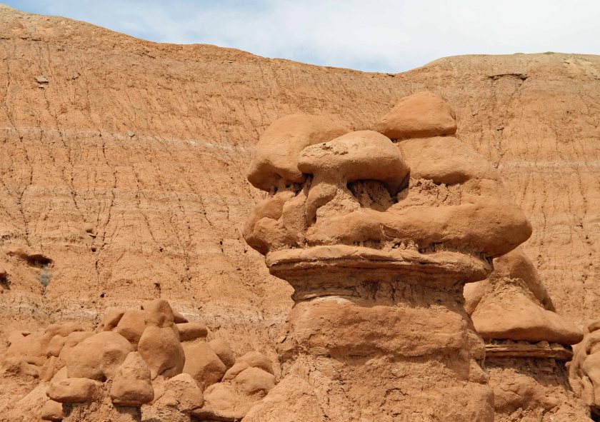
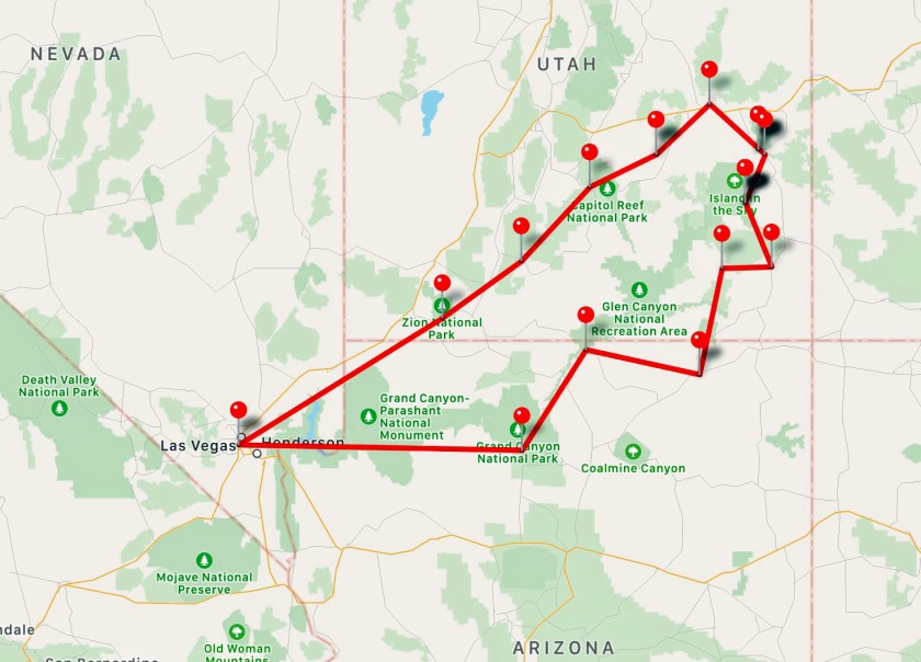
As we left Moab, our plans for the day were very fluid.  We headed south in the general direction of Blanding, UT and were on the lookout for anything that piqued our interest.  Dawne was busy researching online (when she had cellular coverage) and the rest of the crew were reading road signs and scouring through any brochures we had on hand.  We didn’t have to wait long – only 24 miles into our journey, we spotted our first target.

Wilson Arch

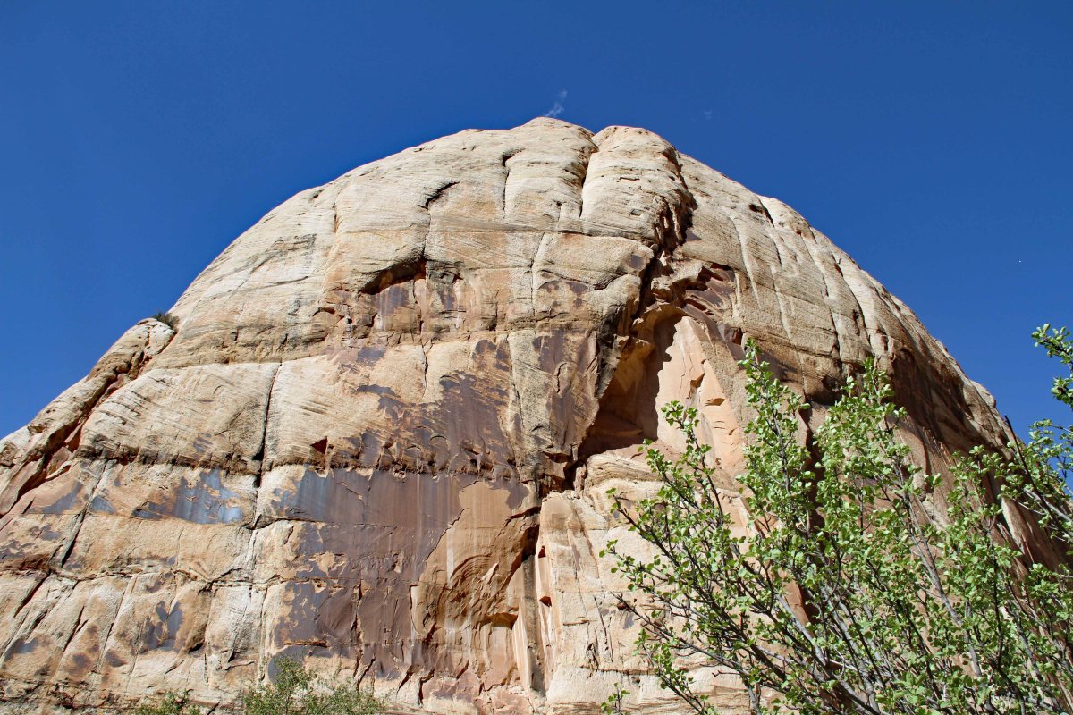
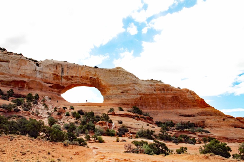
After getting our fill of arches at Arches the day before, Utah added in one more for good measure.  Driving south on UT-191 we came across Wilson Arch, which is visible directly from the road.  It is named for Joe Wilson, who was an early pioneer who had a cabin in nearby Dry Valley.


1EIMG_7527
Wilson Arch
1EIMG_7528
Close-up of Wilson Arch for some perspective on its size.


We were a bit disappointed that we would have to forgo visiting Dead Horse Point State Park and Canyonlands National Park – or so we thought.  We had passed entrances to these sites north of Moab and assumed our chance to visit on this trip was lost.  We were pleasantly surprised when we saw signs for access to Canyonlands and Newspaper Rock via UT-211.
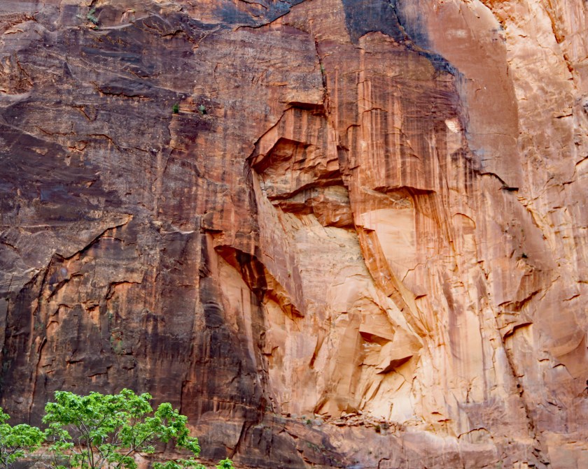
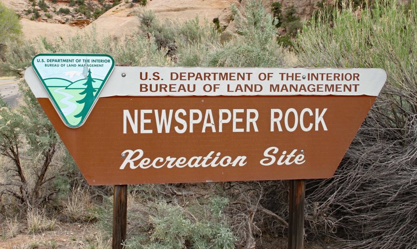
Newspaper Rock

We made a quick stop at Newspaper Rock, which is a collection of petroglyphs dating back over 2,000 years.  We learned that petroglyphs are images created by removing the surface of the rock by carving or engraving.  In this case the rock has a dark exterior coating.  Apparently the locals have been stopping by for thousands of years to catch up on the “latest” news.
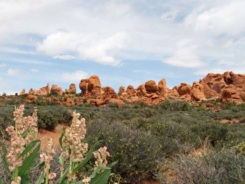
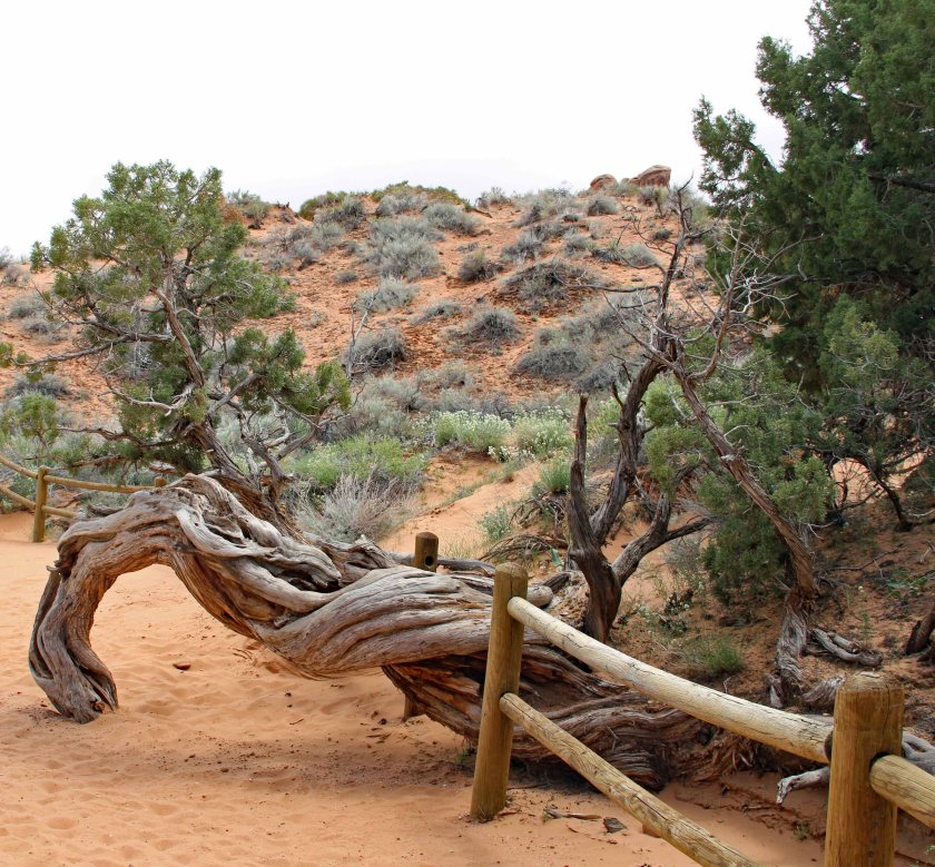
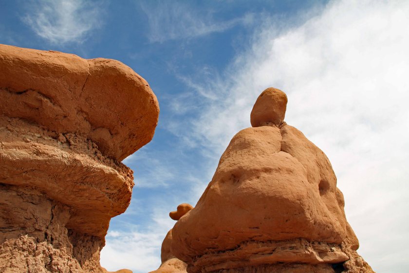
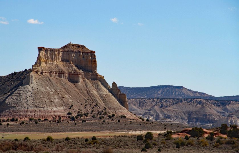
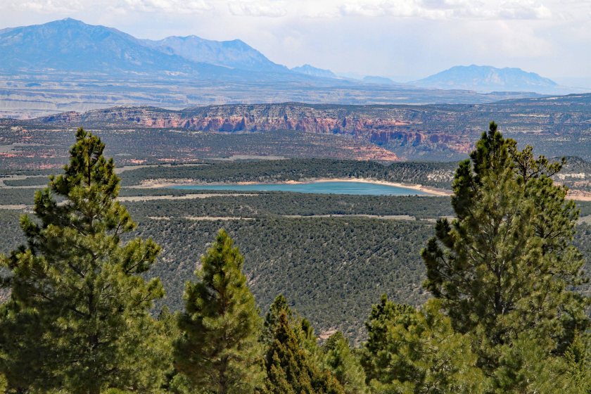
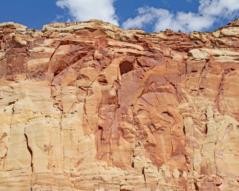
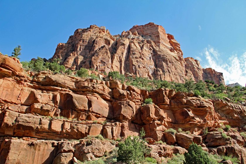
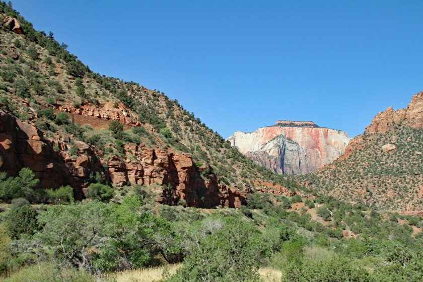
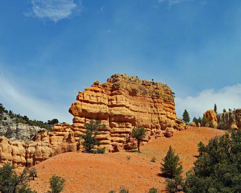
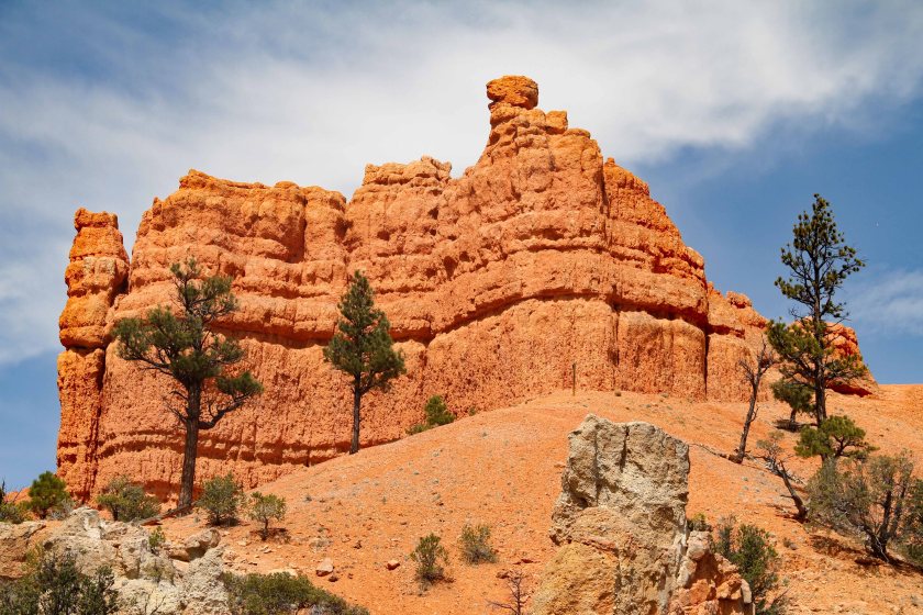
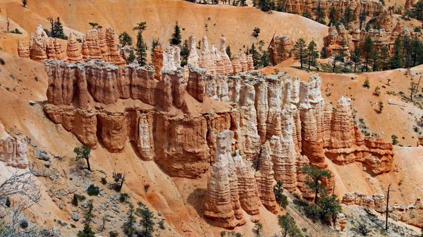
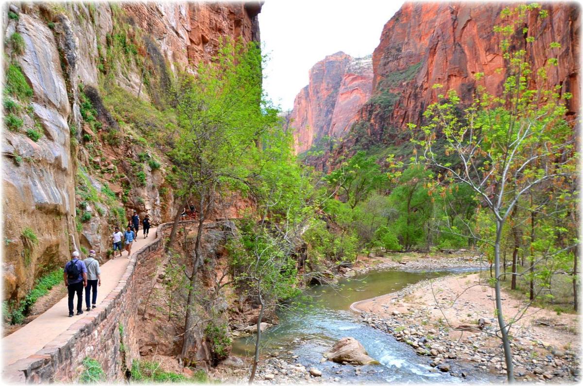
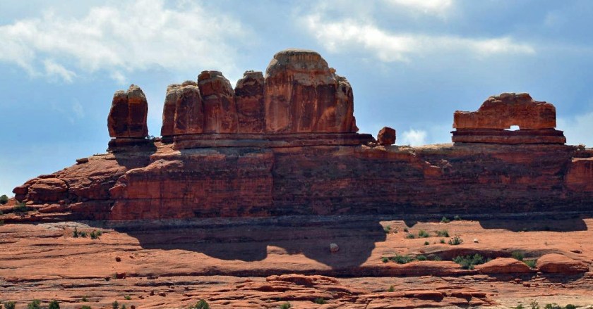
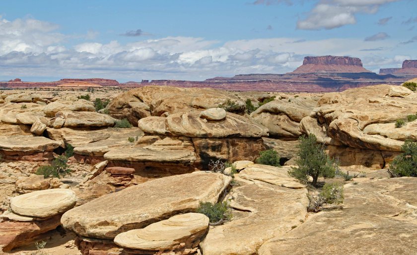
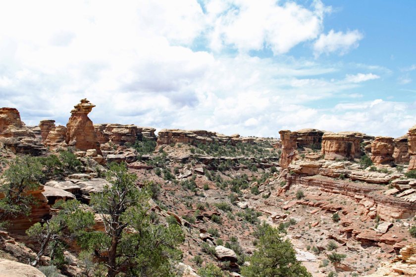
1EIMG_75301EIMG_75341EIMG_7535

Canyonlands

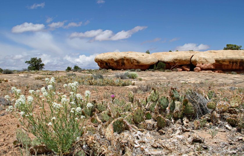
Canyonlands is a vast National Park covering 527 square miles and is less frequented by visitors than other national parks – probably because its roads are mainly unpaved and its trails are more primitive.  There are two entrances and we were fortunate to stumble upon the southeast entrance.  The confluence of the Green and Colorado Rivers is located within the park, but is accessible only by four-wheel drive vehicles.

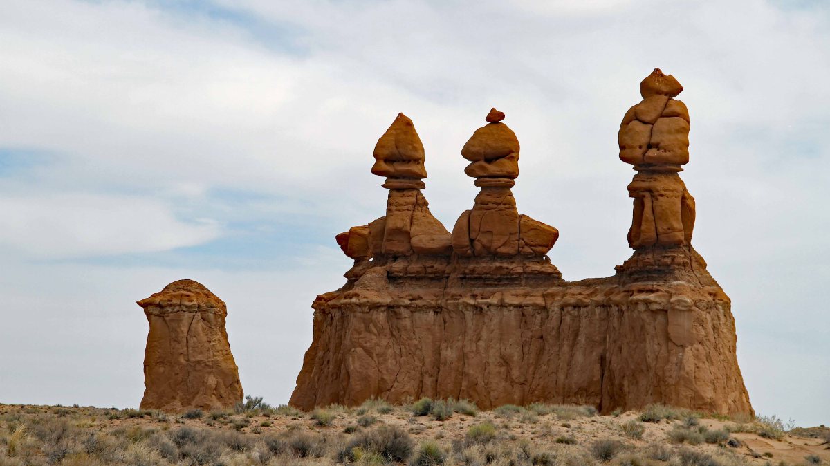
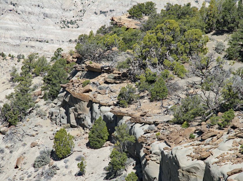
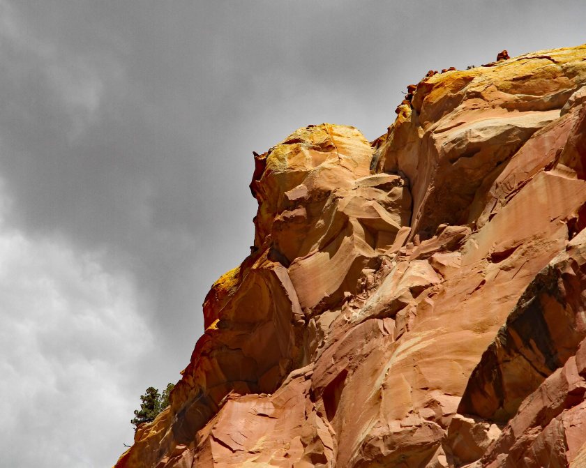
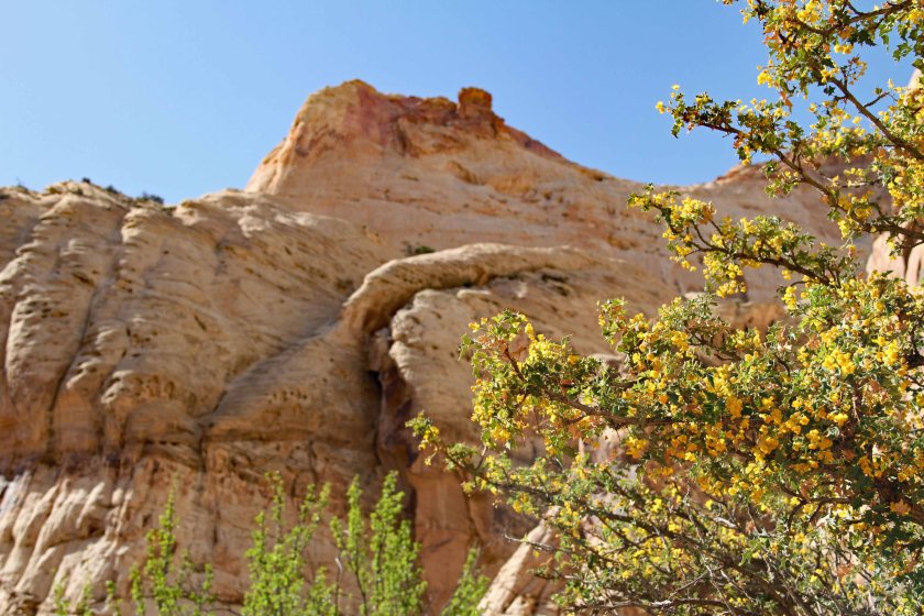
We made stops at Wooden Shoe Arch Overlook and Pothole Point. The vistas were amazing as we scanned across multiple canyons and intriguing rock formations.

5Jan9
Wooden Shoe Arch
3EIMG_7574
Needles District in the background.
4Jan 2
Close-up of the Needles District.

4Jan 13EIMG_75773EIMG_75723EIMG_75703EIMG_75985Jan 104Jan 34Jan 45EIMG_7560

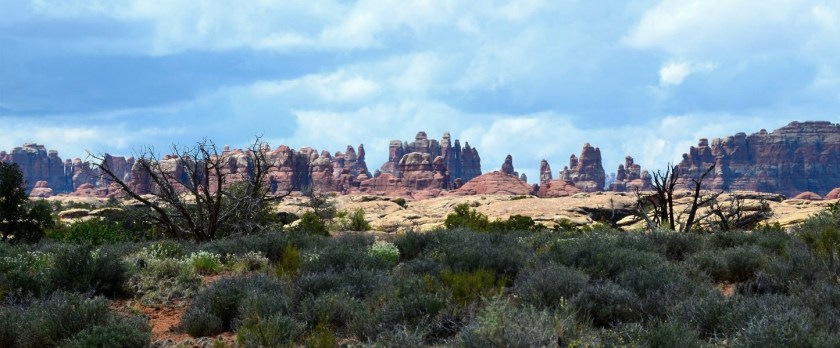
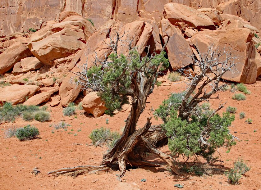
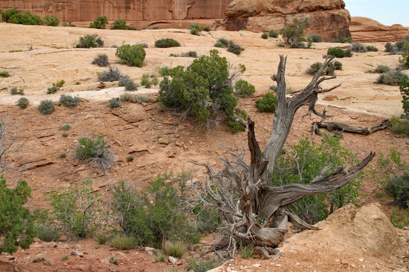
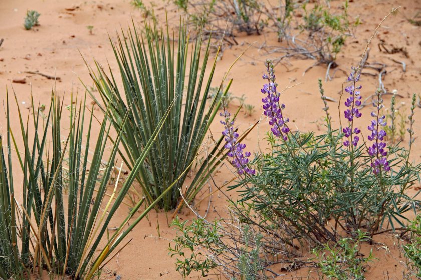
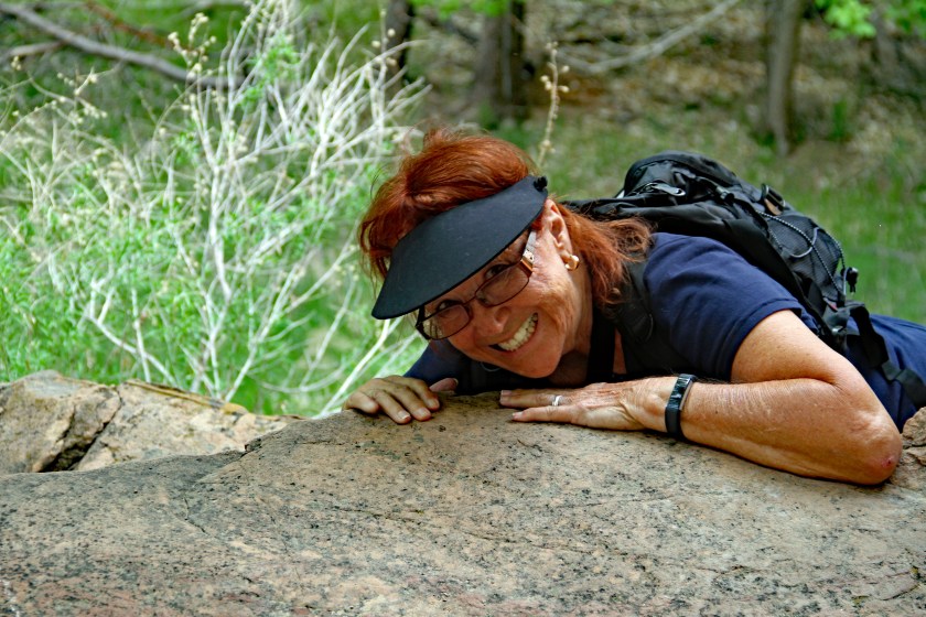
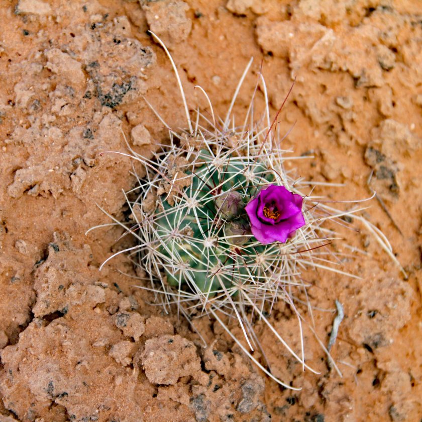
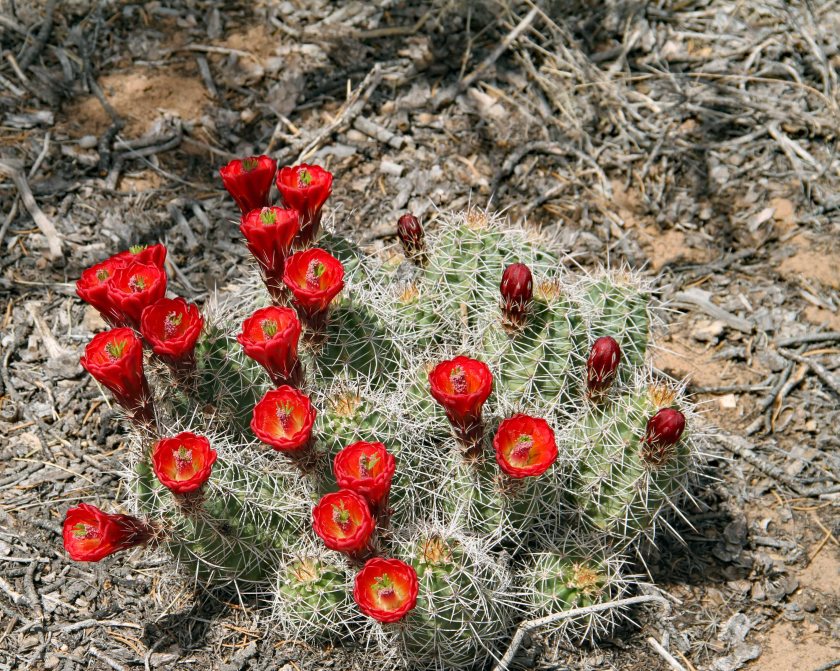
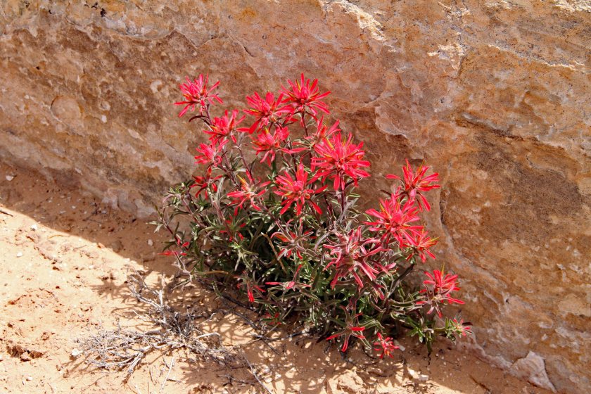
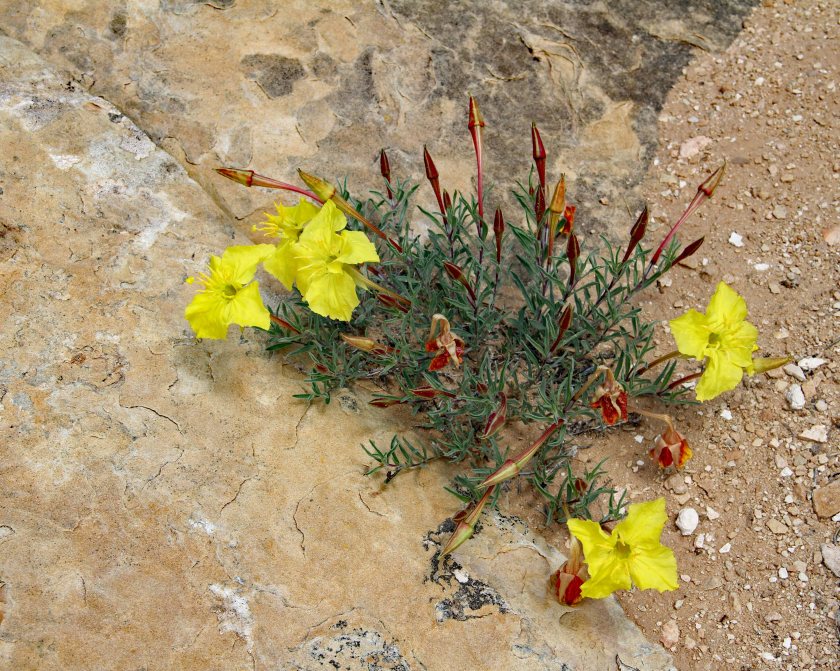
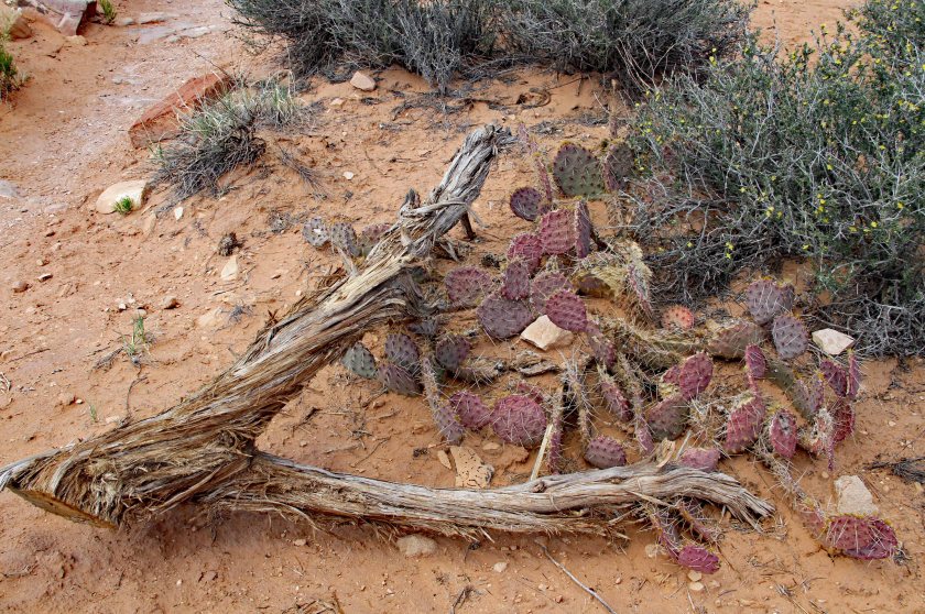
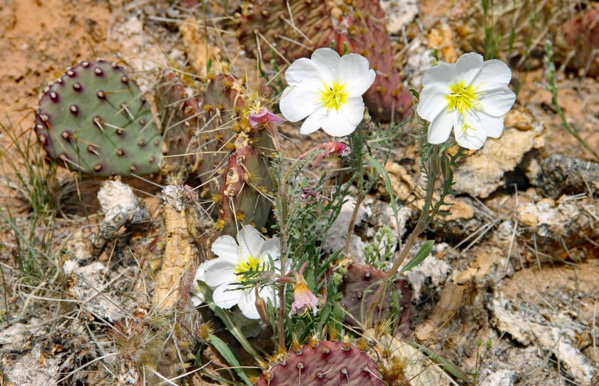
We were particularly impressed with the variety of colorful plant life.

1EIMG_75551EIMG_75621EIMG_75641EIMG_75651EIMG_75811EIMG_75901EIMG_75921EIMG_7597

1EIMG_75475EIMG_7586

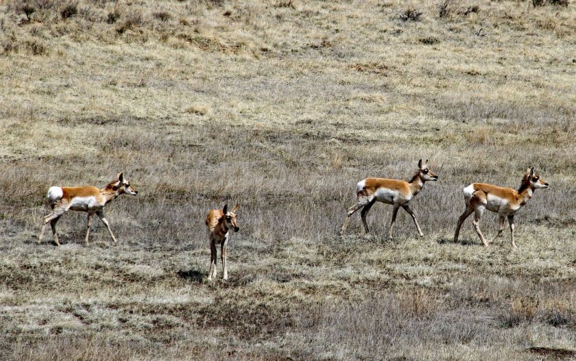
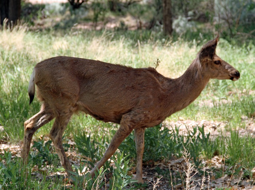
Apparently, the park is home to a wide variety of wildlife (bighorn sheep, coyotes, etc.), but we were only lucky enough to spot several lizards and one very friendly raven.
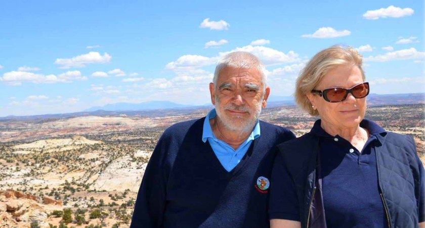
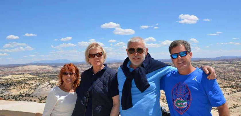
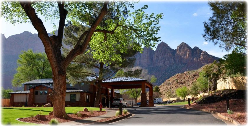
1raven2EIMG_7550

Utah’s Mighty Five

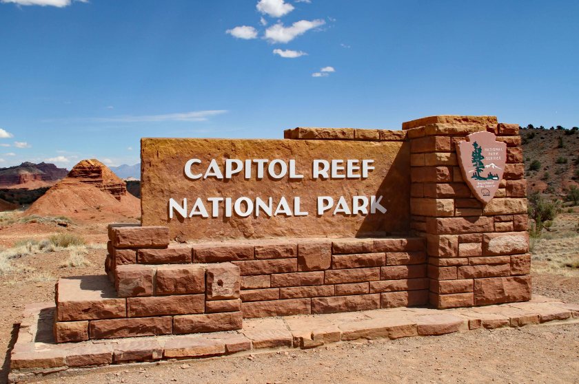
As an added bonus, we realized that we had now completed the list of Utah’s Mighty Five, comprised of Zion, Bryce, Capitol Reef, Arches and Canyonlands National Parks.  We were so proud!

The Grand Circle Tour – Day Five – Arches National Park

We left Green River for the short drive to Arches and quickly found out that we were not the only ones that had decided to visit the park that day.  We waited in line for about 45 minutes before gaining access through the entrance station.  (Note to self:  Arrive before 9:00 a.m. to avoid the lines.)  We suspected our day exploring the park would be worth the wait and we were definitely not disappointed.  It was loaded with so many check-the-box photo opportunities.

1IMG_7376.jpg

The park is home to over 2,000 natural sandstone arches, in addition to a variety of unique geological formations.  It contains the highest density of natural arches in the world.

EJan 4
Stefan and Ann strike a pose at the Park Avenue Viewpoint.
4EIMG_7515
Elephant Butte

2EIMG_74592EIMG_74482EIMG_7454

1EIMG_7393
Quick group photo at our first stop – the Park Avenue Viewpoint.


With so much to see and do, we decided the best approach was to use our vehicle and hit as many scenic overlooks as possible.  The layout of the park involves a long, winding road from the entrance station to the Devil’s Garden with a couple of spurs along the way.  There are numerous hiking trails to explore to gain closer access to sites, but our schedule limited our opportunity for hiking.

As we toured the park, we were constantly in awe of Mother Nature’s beauty.  The arches and rock formations were spectacular.


1EIMG_7381
Queen Nefertiti’s Head

1EIMG_73861EIMG_7394


1EIMG_7399
The Three Gossips can be spotted near the center of the photo in the background.
1EIMG_7406
Balanced Rock from a distance.

1EIMG_7410


1EIMG_7416
Close-up of Balanced Rock

1EIMG_7435


Highlights of our tour included the iconic Delicate, Landscape and Double Arches.

2EIMG_7438

2EIMG_7440
Delicate Arch – Notice people hiking around the base for some perspective on its size.

2EIMG_7452

2EIMG_7456
Skyline Arch

2EIMG_74602EIMG_7463

2EIMG_7464
Another view of Skyline Arch.
2EIMG_7467
Gnarled tree near Skyline Arch.


We were also impressed with the diversity of plant life in the high desert.  We saw red, orange, yellow, purple and white flowering plants along the way and an abundance of gnarled evergreen trees and cacti.

3EIMG_74683EIMG_7470

3EIMG_7473
The trail to Landscape, Pine Tree and Tunnel Arches.
3EIMG_7481
Tunnel Arch

3EIMG_7483


3EIMG_7488
Pine Tree Arch


3EIMG_7489
Pine Tree Arch from another angle.

3EIMG_7494

3EIMG_7501
Landscape Arch

3EIMG_7502

We barely put a dent on the list of 2,000 arches, but managed to have an amazing day.

4EIMG_7509

4EIMG_7520
Approaching Double Arch.
4EIMG_7521
This reminded us of the Sphinx.
4EIMG_7523
Double Arch – Again, spot people hiking in the center of the photo for some perspective.  It really was massive.

4EIMG_7524EJan 1

EJan 2
Jan and Dawne in front of Landscape Arch.

EJan 3

EJan 5
Doing my best impression of Balanced Rock.


The Grand Circle Tour – Day Four – Goblin Valley State Park and Green River, Utah

As we left Torrey, we did not have a nailed-down plan for the day.  We headed toward Green River, UT on SR-24 and were on the lookout for interesting places to investigate.  As we crossed a very desolate area of high desert, we saw signs for Goblin Valley State Park and decided to check it out.

Jan 8
Did I mention that the area was desolate?!?

Utah once again had an unexpected surprise for us.  Goblin Valley is a series of five buttes and a valley of strange-shaped rock formations (goblins) surrounded by a wall of eroded cliffs.  The park brochure explains that the area was sculpted by forces of nature acting on deposits of Entrada sandstone laid down 170 million years ago by a vast inland sea.  Some goblins resemble trolls or garden gnomes, while others look like mushrooms.  We even spotted one that resembled Steven Spielberg’s E.T.

EJan 3EJan 41EIMG_7356EJan 2

EJan 1
Dawne making her way down into the valley.

Rich Rock Head1EIMG_73651EIMG_73621EIMG_7360

1EIMG_7366
Stefan very carefully balances a rock on his head.

EJan 7

EJan 6
This goblin was an E.T. look-alike.

1EIMG_73591EIMG_73551EIMG_73511EIMG_73501EIMG_73491EIMG_7348

1EIMG_7345
A series of troll-like goblins.

1EIMG_73461EIMG_7344

After spending time with the goblins, we headed on to Green River.  Our options for entertainment were limited in the sprawling metropolis (population 943), so we decided to check out the John Wesley Powell River History Museum.

john-wesley-powell-river

We were intrigued as we learned the story of Powell and his band of frontiersmen, who embarked on an expedition down the Green and Colorado Rivers to study and document the previously-unexplored region.  We watched a short film, which chronicled their journey.  As they travelled down the rivers in wooden boats in 1869, they experienced a series of hardships, including the loss of boats and supplies, near-drownings and the departure of some crew.

Particularly impressive was the fact that Powell survived the expedition through the rugged territory with only one arm.  His right arm was amputated below the elbow after being wounded by a musket ball in the Battle of Shiloh in the Civil War.  Also intriguing was the fact that three of the men, who abandoned the journey prior to a particularly-treacherous stretch of rapids, were never seen or heard from again.

We struggled to put our evening happy hour together at the River Terrace Inn.  We found ourselves eating two-toned, plastic-tasting cheese that was purchased from the mini mart of a local gas station – not exactly our best effort.  However, all was not lost as we found great burgers and a very friendly server at Ray’s Tavern.

ERay's Tavern.jpg

The Grand Circle Tour – Day Three – Capitol Reef National Park

Traveling From Bryce to Torrey and Touring Capitol Reef

Again on day three, the journey was part of the entertainment.  Traveling along Utah SR-12 was something special.  It is nicknamed the All-American Road and we were treated to amazing sights and panoramas all along the way.

1EIMG_7238

1EIMG_7242
This reminded us of a Greek or Roman ruin.
1EIMG_7244
Rugged Ranch Building

1EIMG_72461EIMG_72531EIMG_7271

1EIMG_7265
Utah’s SR-12 – Scenic Byway – The All-American Road

1Jan CR 71Jan CR 81EIMG_72751EIMG_7256


1EIMG_7277
St Anthony of the Desert Catholic Church in Torrey, UT


Capitol Reef is one of the newer national parks.  It was established in 1971 to preserve approximately 378 square miles of desert landscape.  It is about 60 miles long on its north-south axis and is only six miles wide, on average.  The park was named for a line of white Navajo Sandstone cliffs with dome formations that resemble the white domes placed on capitol buildings.

As we approached the park, we did not know what to expect.  However, this time Nature was giving us an abundance of clues that the show was about to start.  All around us were imposing rock formations.  The colors were varied, but were decidedly more reddish than Bryce and Zion.  Below are some sights we encountered at a scenic overlook between the Capitol Reef entrance and the visitor center.

2EIMG_72782EIMG_72822EIMG_72832EIMG_72872EIMG_72912EIMG_72942EIMG_72982EIMG_72992EIMG_7301

2EIMG_7303
Stefan – The Capitol Reef Greeter

After a quick stop at the visitor center to secure a map and some advice, we decided to stay in our vehicle and take the Scenic Drive.  We headed out on the 10-mile road, passing orchards and campgrounds, while surrounded by amazing rock formations in every direction.  The trek was eight miles on a paved road, followed by a two-mile stretch on a dirt road.  (Strangely, the return trip seemed like an entirely different route as we noticed new things from a different perspective.)  The best part was definitely at the end when the pavement stopped and the dirt road began.  As the park ranger explained to me, “It’s the closest thing to hiking through a slot canyon on foot that you can experience in a car.”  He was not wrong – the canyon walls closed in and the views were fantastic.

3EIMG_73053EIMG_7312

3EIMG_7313
When you spend a lot of time with the rocks, you start to see things.  How many faces do you see here?

3EIMG_73153EIMG_7320

3EIMG_7324
White Navajo Sandstone Dome – Perhaps a “Capitol” Dome

3EIMG_73273EIMG_73293EIMG_7330


The Grand Circle Tour – Day Two – Bryce Canyon National Park

The Trip From Zion to Bryce (AKA Hoodoo Heaven)

After a nice buffet breakfast, we headed out toward Bryce Canyon National Park.  We would be staying in Bryce City, which is adjacent to the park.  To get there, we passed through the entrance of Zion National Park and immediately found ourselves on a road with spectacular views all around.  The Zion Park Scenic Byway (SR-9) brought to mind the phrase “Enjoy the journey.”  In Utah, you don’t simply drive from point A to point B, the trip itself is part of the show.  The winding road took us through incredible rock formations and we had to make several stops at overlook points to take in the beauty.  The road rose and fell as we traversed several switchbacks and passed through tunnels carved through solid rock.

1EIMG_71211EIMG_71221EIMG_7126

1EIMG_7131
Checkerboard Mesa

1EIMG_7134

Along the way, we also encountered the Dixie National Forest and Red Canyon.  Here we saw rock formations that looked decidedly different than anything we had seen before.  They were starting to look more hoodoo-like (more on that later).

2EIMG_71372EIMG_7138

2EIMG_7140
Sagebrush was growing all along the sides of the road.

2EIMG_71432EIMG_71502EIMG_7152

As we approached Bryce Canyon, we did not know what to expect.  The landscape was deceptive, as we had gradually increased our altitude on the trek from Zion.  We were now atop a plateau and would be looking down on the landscape, rather than up, as we were in Zion.  There were no soaring rock walls to tip us off about the beauty we were about to experience.

The road through Bryce Canyon National Park is an 18 mile, out-and-back stretch with multiple vantage points along the way.  The setup was also different from that of  Zion; here we were in our own vehicle, hitting overlook points at our leisure, rather than touring via shuttle bus.

We all agreed that we hit the best part of the park first.  The Amphitheater can be viewed from four different vantage points.  We stopped at both Sunset Point and Bryce Point and were in awe of the landscape below – simply jaw-dropping to experience in person.

The park contains the world’s largest collection of hoodoos and they are spectacular.  We also checked out views from several other viewpoints: Natural Bridge, Agua Canyon, Rainbow Point, Yovimpa Point, Ponderosa Point and Swamp Canyon.

3EIMG_71573EIMG_71593EIMG_71603EIMG_71643EIMG_71653EIMG_71663EIMG_71683EIMG_71703EIMG_71713EIMG_71723EIMG_71783EIMG_71803EIMG_7187

3EIMG_7192
Natural Bridge, which is technically an arch and not a bridge.

3EIMG_71993EIMG_72123Jan Bryce 13Jan Bryce 2

3Jan Bryce 3
Doing my best impression of a hoodoo.


More on hoodoos:  These are tall, thin columns of rock that generally rise from the bottom of a drainage basin.  They typically consist of soft rock that is topped by harder, less-easily eroded stone.  Hoodoos have a variable thickness and are sometimes described as having a “totem pole-shaped body.”  They differ from a classic spire, which has a smoother profile and a more uniform thickness that tapers from the ground up.  We heard many explanations on the origin of the word “hoodoo,” but I settled on the one related to the original inhabitants of the land, the Paiute Indians.  They called the rocks hoodoos, which meant “ancient peoples, who were turned to stone as the result of bad deeds.”  Don’t be a hoodoo.

The Grand Circle Tour – Day One – Zion National Park

Springdale, Utah and Zion National Park

We arrived in Springdale and headed directly to our hotel – the Best Western Plus.  We learned that the hotel had only recently opened for business, so everything was crisp and clean and new.  The town itself was very picturesque with upscale shops and art galleries dotted along the beautifully-landscaped main road.  We could see the imposing mountains of red rock to the east and to the west, reminding us of the purpose of our visit.

Zion National Park covers 229 square miles.  Its most prominent feature is Zion Canyon, which stretches 15 miles long and is up to a half a mile deep in places.  The canyon was cut through the reddish and tan-colored Navajo Sandstone by the north fork of the Virgin River.

BWP Zion
Best Western Plus With Mountains In The Background

After a quick trip to the Switchback Restaurant and Store to secure happy hour provisions for later, we decided to head to the park.  The friendly hotel staff explained that parking inside of Zion was scarce, so they suggested that we take the free shuttle service to the park entrance.  We hopped on the shuttle at stop #4 (directly in front of the hotel) and were at the park a few minutes later.

After passing through the entrance, we grabbed some trail mix and granola bars for a quick, on-the-go lunch.  We then jumped on the courtesy shuttle inside the park and headed to the furthest stop (#9) to reach the Riverside Walk.

The shuttle ride itself was a treat.  Our heads were on a swivel trying to take in the amazing vistas all around us.  At the trailhead, we were intrigued by a rock climber making his ascent up a sheer cliff face.

As we walked along the Virgin River, there were soaring rock walls on both sides.

EIMG_7052EIMG_7094EIMG_7100rich and dawneEIMG_7055jan zion 1

jan zion 2
Bridge to the Park Entrance
jan zion 3
The Virgin River
jan zion 4
Path Along the Riverside Walk

EIMG_7056

EIMG_7106
Picasso Face

EIMG_7070EIMG_7092EIMG_7053EIMG_7114

We saw surprisingly-tame rock squirrels, deer and wild turkeys along the way.

EIMG_7097EIMG_7050turkey

After shuttling back to the hotel, we enjoyed a short happy hour in Jan and Dawne’s room and then headed out to Pizza and Noodle for a casual dinner.  We all chose the house specialty of Chicken Parmesan, which was delicious.  After dinner, we returned to the hotel, had a final nightcap and retired to our rooms for a much-needed night of sleep.

The Grand Circle Tour – Overview

The Adventure Begins

I recently had the pleasure of taking a trip to the American Southwest with some very good friends of mine.  The trip was planned by our fearless leader, Jan (pronounced “yawn”), who is an extremely organized and regimented Swede.  We needed someone to take charge and he certainly did.  He spent countless hours researching potential routes, points of interest, accommodations, and modes of transportation.

In the months leading up to the trip, Jan would regularly send out emails with suggestions and options and ask for our input.  We would, in turn, respond with, “Sounds great,” or, “Whatever you think is best,” and then carefully file away the emails for future reading.  It is a wonder he did not get frustrated with our lack of input and decide to either go it alone or find other more-engaged travel partners.  Luckily for us, he did not.  He deserves full credit for the bulk of the planning and the ultimate itinerary.

3Jan Bryce 2
Jan – Our Fearless Leader

After careful consideration (mostly by Jan), it was determined that we would start and end our tour in Las Vegas and make a big loop (The Grand Circle) covering over 1,600 miles.   We would visit six national parks, multiple state parks and several other sites along the way.  We decided to forgo the use of an RV and rent a minivan, which would be more flexible and practical when accessing the parks.

1GCMap
The Grand Circle Route – Starting and ending in Las Vegas
KIA
Our stylish Kia Sedona with Plastic New York in the background.  Also available for viewing while in Vegas: Plastic Paris and Plastic Venice.

The other members of our crew included Jan’s lovely American wife, Dawne, and the ever-pleasant Swedish couple, Stefan and Ann.  I always say that you never really know someone until you travel together.  Spending day after day on the road with people can result in some uncomfortable and awkward moments, unless you have similar temperaments and expectations.  Having known all of the crew for many years, I knew we would be a great fit – and we were.

aCrew
The Crew

We had so many laughs along the way as we took in the breathtaking scenery and landscapes.  On some days, our plans were pretty nailed down and we would visit a specific national park for the bulk of a day.  On other days, our plans were more open-ended and flexible with only a general direction in mind and a list of potential places to investigate along the way.  On the open-ended days, Jan would typically ask for input and he was usually met with four blank stares.  He would then politely remind us that we had not completed our homework assignments.  This then resulted in four of us frantically searching the internet (when we had coverage) or leafing through travel brochures to find suggestions for the day.

After gathering in Las Vegas (one of my least favorite places on the planet), we headed out in late April, in our trusted Kia Sedona.  The contrast between the man-made, plastic, neon world of Vegas and the sights we were about to experience could not have been more stark.

Note:  Photo credits to all Grand Circle Posts go to Jan, Dawne, Stefan, Ann and me.

Rich Horseshoe Bend
A Preview of the Amazing Sites We Would Encounter – Horseshoe Bend, AZ